Hiking Multnomah Falls, Oregon
How did we do it?
Let’s not mess around – We hiked it. We put our pants on one leg at a time and we hiked it.
Is Multnomah Falls considered an “easy” hike? By most accounts, yes. But pinch that grain of salt over your shoulder and recognize that 620 feet of elevation gain over 1.1 miles isn’t exactly a walk in the park.
Route
Parking can range from hilariously convenient to nightmarish and grizzly. As with most hiking destinations, the crowds typically flood in on sunny weekends, especially during the spring and summer months.
Considering the popularity of this hike don’t count on a little drizzle or an overcast morning to keep the tides at bay. As with most Columbia River Gorge hikes the best option is to arrive early.

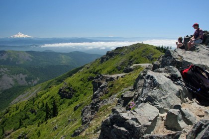
Did you make it to the lodge? Great kid, but don’t get cocky. By this point you should be able to see and hear the falls leaping into the air and crashing 620 feet onto the rocks below. It might have seemed a bit mysterious and shy from the parking lot, but move closer onto the viewing platform below the falls. Now you will start to get a sense of just how violent and powerful the Multnomah Falls are.
From the viewing platform you will undoubtedly look up and see a bridge. That’s Benson Bridge! It closes the rocky gap that sits about a third of the way up and directly in front of the falls. You might catch a glimpse of people piling on top of each other trying to reach the bridge. And while it won’t seem appealing at first you should push on – It’s only a quarter of a mile and if Vin Diesel can live his life a quarter mile at a time, then so can you. If you’ve got a little one, be a (wo)man and put it on your shoulders – no time for stragglers on this section of the hike.

So you made it to Benson Bridge and are marveling at the awesomeness of Multnomah Falls in all of the glory that a first-person view can give you. Congratulations! You may have taken a few elbows to the kidneys, but you made it.
Bonus round!
Now, the proverbial phrase “separate the wheat from the chaff” may not be terribly meaningful to you – unless you happen to be a grain farmer, but Benson Bridge is typically where most people turn around. So you have to ask yourself – Do I want to be the wheat or the chaff?
From this point it’s another 0.8 of a mile through 11 switchbacks to make it to the top. Fortunately, they’re conveniently labeled to allow you to gauge your progress. You might look up at the mouth of the falls, then back down at your hands and think “good golly, that’s a long way up – I don’t know if I’ll be able to make it.” I’m here to tell you, you should take one of those hands and smack yourself in the face, because “yes, you can.” Go ahead, do it – I’ll wait.
Ready? Now the key to ascending any trail with elevation is to find a consistent pace. Don’t try and floor it like you’re back in your GMC Yukon. You’re under your own horsepower, not a block of Detroit iron. A consistent, sustainable pace lets you breathe comfortably and allows for steady progress. Just start putting one foot in front of the other and begin monitoring your body’s response.
The end of a switchback provides a natural resting place due to its typically flat surface. Feel free to use these. It also allows for other hikers to pass, which you should always be aware of. Make room – don’t take up the entire path. Nobody cares about how many bro-chievements you’ve acquired and we think that your $500 sunglasses are a symbol of everything that’s wrong in the world. Don’t be that hiker.

You’re now staring at the sign for switchback 11. “But I don’t see the falls yet?” You mutter out loud to yourself because narcissists continuously think they’re starring in their own movie and have to verbalize the plot to their audience. “That’s okay” says your phone because it’s reading this blog entry out loud to you. You still have 0.1 miles to go before you reach the wooden platform that sits at the top of the falls, but it’s mostly flat.
Look at you, standing there on that platform overlooking the falls. It should feel satisfying because you can now say that you truly made it to the top of the largest waterfall in Oregon. If you feel like celebrating, take a dip in the stream. Obviously not right next to the edge of the falls, but further up there are a number of shallow, accessible spots where you can soak in the cold runoff of Larch Mountain. Also – No, you still cannot take your pants off.
ADVERTISEMENTS
Gear
Third party sources told us that the only true gear requirement was pants.

Food & Water
We consumed bears and protein pucks, but that’s just us.
Bring a reasonably sized water bottle that you feel comfortable carrying. Drinking from the falls is not recommended because of the various ways that downstream water can be contaminated.