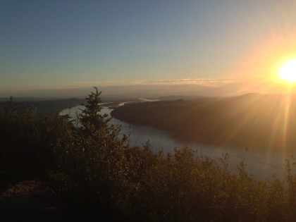
The clear skies and shining sun were deceptively welcoming. With temperatures approaching -18°F and short bursts of wind ranging between 40 – 50 MPH, losing a bag of snap peas over the side of the mountain was one thing, succumbing to the elements was quite another.
After the wind gust had passed, my climbing partner yelled, “We need to turn back. We have an hour of daylight left and the temperature will drop even further once the sun goes down.” Reluctantly, I agreed.[/vc_column_text][/vc_column][/mk_page_section][mk_page_section bg_image=”https://wanderlusthiker.com/wp-content/uploads/2015/01/vlcsnap-2015-01-31-08h25m56s185.png” bg_position=”center center” bg_stretch=”true” mask=”true” full_height=”true” full_width=”true”][vc_column width=”1/3″][mk_icon_text skin=”light” default_txt=”What is it?” link=”#What_is_it” icon=”mk-theme-icon-accordion”][/vc_column][vc_column width=”1/3″][mk_icon_text skin=”light” default_txt=”Where is it?” link=”#Where_is_it” icon=”mk-icon-map-marker”][/vc_column][vc_column width=”1/3″][mk_icon_text skin=”light” default_txt=”How did we do it?” link=”#How_did_we_do_it” icon=”mk-flaticon-compass39″][/vc_column][/mk_page_section][mk_page_section][vc_column][vc_row_inner][vc_column_inner width=”1/3″][mk_fancy_title font_family=”none”]
At a glance
[/mk_fancy_title][mk_milestone stop=”12″ type=”text” text=”Distance (miles)” border_bottom=”#eeeeee”][mk_milestone stop=”5700″ type=”text” text=”Elevation gain (feet)” border_bottom=”#eeeeee”][mk_milestone stop=”12″ type=”text” text=”Hike time (hours)” border_bottom=”#eeeeee”][/vc_column_inner][vc_column_inner width=”1/3″][mk_fancy_title font_family=”none”]Relative difficulty
[/mk_fancy_title][vc_progress_bar values=”90|Beginner|#FAAC58,75|Intermediate|#F4FA58,50|Experienced|#81F79F” units=”%”][/vc_column_inner][vc_column_inner width=”1/3″][mk_fancy_title font_family=”none”]When to go
[/mk_fancy_title][vc_progress_bar values=”100|Spring|#81F79F,50|Summer|#F4FA58,25|Fall|#FAAC58,75|Winter|#A9F5F2″][/vc_column_inner][/vc_row_inner][vc_raw_html]JTNDaWZyYW1lJTIwaWQlM0QlMjJmb3JlY2FzdF9lbWJlZCUyMiUyMHNyYyUzRCUyMmh0dHAlM0ElMkYlMkZmb3JlY2FzdC5pbyUyRmVtYmVkJTJGJTIzbGF0JTNENDYuMDQ3MSUyNmFtcCUzQmxvbiUzRC0xMjIuMzA4MSUyNmFtcCUzQm5hbWUlM0RDb3VnYXIlMkMlMjBXYXNoaW5ndG9uJTI2YW1wJTNCY29sb3IlM0QlMjMwMGFhZmYlMjIlMjB3aWR0aCUzRCUyMjEwMCUyNSUyMiUyMGhlaWdodCUzRCUyMjI0NSUyMiUyMGZyYW1lYm9yZGVyJTNEJTIyMCUyMiUzRSUyMCUzQyUyRmlmcmFtZSUzRSUwQQ==
[/vc_raw_html][mk_fancy_title style=”avantgarde” size=”8″ font_family=”none” align=”center”]ADVERTISEMENTS
[/mk_fancy_title][vc_raw_html]JTNDc2NyaXB0JTIwYXN5bmMlMjBzcmMlM0QlMjIlMkYlMkZwYWdlYWQyLmdvb2dsZXN5bmRpY2F0aW9uLmNvbSUyRnBhZ2VhZCUyRmpzJTJGYWRzYnlnb29nbGUuanMlMjIlM0UlM0MlMkZzY3JpcHQlM0UlMEElM0MlMjEtLSUyMEhvbWUlMjBwYWdlJTIwcmVzcG9uc2l2ZSUyMGFkJTIwLS0lM0UlMEElM0NpbnMlMjBjbGFzcyUzRCUyMmFkc2J5Z29vZ2xlJTIyJTBBJTIwJTIwJTIwJTIwJTIwc3R5bGUlM0QlMjJkaXNwbGF5JTNBYmxvY2slMjIlMEElMjAlMjAlMjAlMjAlMjBkYXRhLWFkLWNsaWVudCUzRCUyMmNhLXB1Yi01NTM4NTAwNTg3MTA4NTQ2JTIyJTBBJTIwJTIwJTIwJTIwJTIwZGF0YS1hZC1zbG90JTNEJTIyMjU5Nzg2MTMxMSUyMiUwQSUyMCUyMCUyMCUyMCUyMGRhdGEtYWQtZm9ybWF0JTNEJTIyYXV0byUyMiUzRSUzQyUyRmlucyUzRSUwQSUzQ3NjcmlwdCUzRSUwQSUyOGFkc2J5Z29vZ2xlJTIwJTNEJTIwd2luZG93LmFkc2J5Z29vZ2xlJTIwJTdDJTdDJTIwJTVCJTVEJTI5LnB1c2glMjglN0IlN0QlMjklM0IlMEElM0MlMkZzY3JpcHQlM0U=
[/vc_raw_html][/vc_column][/mk_page_section][mk_page_section bg_image=”https://wanderlusthiker.com/wp-content/uploads/2015/02/01e35ba4d1204d8cf688f5788bb494741b9841c745.jpg” bg_position=”center center” bg_repeat=”no-repeat” bg_stretch=”true” full_height=”true” full_width=”true”][vc_column][vc_column_text] [/vc_column_text][/vc_column][/mk_page_section][mk_page_section][vc_column][mk_fancy_title tag_name=”h1″ font_family=”none”]What is it?
[/mk_fancy_title][vc_column_text]On May 18, 1980, an earthquake caused the entire north face of the mountain to slide away creating the largest landslide ever recorded. This triggered a catastrophic eruption, 1,600 times the size of the atomic bomb dropped on Hiroshima, which spewed molten rock and ash as far as 19 miles away, utterly devastating the once pristine northern landscape. 57 people were killed and 200 houses, 27 bridges, 15 miles of railways and 185 miles of highway were destroyed. Prior to the eruption, the mountain stood at 9,677 feet; now the summit sits at 8,363 feet.A little over 10 years later, my parents moved to the Pacific Northwest. As a child I couldn’t help but stare with wonder at this damaged-looking behemoth every day as I came home from school along north SR 503. Years later as I began hiking around the region the mountain would spectate; it would appear above the tree line as I came to a clearing on the trail. Other times it would sit majestically on the horizon as I reached the summit of some smaller peak. Of all the mountains in the region it seemed to be the most personable and attainable.[/vc_column_text][vc_gallery interval=”5″ images=”379,380,447″ img_size=”large”][/vc_column][/mk_page_section][mk_page_section][vc_column][mk_fancy_title tag_name=”h1″ font_family=”none”]
Where is it?
[/mk_fancy_title][vc_column_text] [/vc_column_text][mk_fancy_title style=”avantgarde” size=”8″ font_family=”none” align=”center”]ADVERTISEMENTS
[/mk_fancy_title][vc_raw_html]JTNDc2NyaXB0JTIwYXN5bmMlMjBzcmMlM0QlMjIlMkYlMkZwYWdlYWQyLmdvb2dsZXN5bmRpY2F0aW9uLmNvbSUyRnBhZ2VhZCUyRmpzJTJGYWRzYnlnb29nbGUuanMlMjIlM0UlM0MlMkZzY3JpcHQlM0UlMEElM0MlMjEtLSUyMEhvbWUlMjBwYWdlJTIwcmVzcG9uc2l2ZSUyMGFkJTIwLS0lM0UlMEElM0NpbnMlMjBjbGFzcyUzRCUyMmFkc2J5Z29vZ2xlJTIyJTBBJTIwJTIwJTIwJTIwJTIwc3R5bGUlM0QlMjJkaXNwbGF5JTNBYmxvY2slMjIlMEElMjAlMjAlMjAlMjAlMjBkYXRhLWFkLWNsaWVudCUzRCUyMmNhLXB1Yi01NTM4NTAwNTg3MTA4NTQ2JTIyJTBBJTIwJTIwJTIwJTIwJTIwZGF0YS1hZC1zbG90JTNEJTIyMjU5Nzg2MTMxMSUyMiUwQSUyMCUyMCUyMCUyMCUyMGRhdGEtYWQtZm9ybWF0JTNEJTIyYXV0byUyMiUzRSUzQyUyRmlucyUzRSUwQSUzQ3NjcmlwdCUzRSUwQSUyOGFkc2J5Z29vZ2xlJTIwJTNEJTIwd2luZG93LmFkc2J5Z29vZ2xlJTIwJTdDJTdDJTIwJTVCJTVEJTI5LnB1c2glMjglN0IlN0QlMjklM0IlMEElM0MlMkZzY3JpcHQlM0U=
[/vc_raw_html][vc_column_text]Use a map or GPS and follow the signs. The road is well marked and you should be able to find your desired trailhead without difficulty. However, be wary of icy roads and pot holes as well as fallen rocks and branches.In the winter it is wise to carry snow chains in case there is significant snow coverage on the roads. Fortunately, on the days we went, NF-43 was freshly plowed and there was equipment on standby in case a new storm rolled through.[/vc_column_text][/vc_column][/mk_page_section][mk_page_section bg_image=”https://wanderlusthiker.com/wp-content/uploads/2015/02/012fd75f4864926120675e8c36f714eba7ab7a4b3d.jpg” bg_position=”center center” bg_repeat=”no-repeat” bg_stretch=”true” full_height=”true” full_width=”true”][vc_column][vc_column_text] [/vc_column_text][/vc_column][/mk_page_section][mk_page_section][vc_column][mk_fancy_title tag_name=”h1″ font_family=”none”]
How did we do it?
[/mk_fancy_title][vc_column_text]After following the 28 mile loop around Mt. St. Helens known as Loowit Trail, I concluded that one day I would reach the summit.
[/vc_column_text][mk_fancy_title tag_name=”h2″ font_family=”none”]Route
[/mk_fancy_title][vc_single_image image=”391″ img_size=”large” alignment=”center”][mk_fancy_title style=”avantgarde” size=”8″ font_family=”none” align=”center”]ADVERTISEMENTS
[/mk_fancy_title][vc_raw_html]JTNDc2NyaXB0JTIwYXN5bmMlMjBzcmMlM0QlMjIlMkYlMkZwYWdlYWQyLmdvb2dsZXN5bmRpY2F0aW9uLmNvbSUyRnBhZ2VhZCUyRmpzJTJGYWRzYnlnb29nbGUuanMlMjIlM0UlM0MlMkZzY3JpcHQlM0UlMEElM0MlMjEtLSUyMEhvbWUlMjBwYWdlJTIwcmVzcG9uc2l2ZSUyMGFkJTIwLS0lM0UlMEElM0NpbnMlMjBjbGFzcyUzRCUyMmFkc2J5Z29vZ2xlJTIyJTBBJTIwJTIwJTIwJTIwJTIwc3R5bGUlM0QlMjJkaXNwbGF5JTNBYmxvY2slMjIlMEElMjAlMjAlMjAlMjAlMjBkYXRhLWFkLWNsaWVudCUzRCUyMmNhLXB1Yi01NTM4NTAwNTg3MTA4NTQ2JTIyJTBBJTIwJTIwJTIwJTIwJTIwZGF0YS1hZC1zbG90JTNEJTIyMjU5Nzg2MTMxMSUyMiUwQSUyMCUyMCUyMCUyMCUyMGRhdGEtYWQtZm9ybWF0JTNEJTIyYXV0byUyMiUzRSUzQyUyRmlucyUzRSUwQSUzQ3NjcmlwdCUzRSUwQSUyOGFkc2J5Z29vZ2xlJTIwJTNEJTIwd2luZG93LmFkc2J5Z29vZ2xlJTIwJTdDJTdDJTIwJTVCJTVEJTI5LnB1c2glMjglN0IlN0QlMjklM0IlMEElM0MlMkZzY3JpcHQlM0U=
[/vc_raw_html][vc_column_text]There are two routes that provide direct access to the summit:- Ptarmigan Trail via Climbers Bivouac
- Summer route
- ~10 mi round-trip
- ~4,500 ft. elevation gain over 5 mi
- WormFlowsviaMarbleMountainSno-park
- Winter route
- ~12.0 mi round-trip
- ~5,700 ft. elevation gain over 6 mi
Climbers Bivouac to Ptarmigan Trail is the shortest route to Monitor Ridge and the summit, but is typically closed during the winter months due to snow.
Marble Mountain Sno-park is generally open to the public year-round, however this route increases the round-trip distance by a few miles. Our group used this route during our second and third attempts in December and January respectively.
The mountain is open to the public for climbing year-round, but requires a visibly displayed permit above 4,800 feet. During the winter months a permit can be obtained for free at either of the trailheads. During the spring and summer months a permit will need to be purchased. Information on how to obtain one can be found on the Mount Saint Helens Institute web site.[/vc_column_text][vc_single_image image=”400″ img_size=”large” alignment=”center”][/vc_column][/mk_page_section][mk_page_section bg_image=”https://wanderlusthiker.com/wp-content/uploads/2015/02/01fc9da0c655272ef20468b7d761fa2d4e6f7bac66.jpg” bg_position=”center center” bg_repeat=”no-repeat” bg_stretch=”true” full_height=”true” full_width=”true”][vc_column][vc_column_text] [/vc_column_text][/vc_column][/mk_page_section][mk_page_section][vc_column][mk_fancy_title tag_name=”h2″ font_family=”none”]
Gear
[/mk_fancy_title][vc_column_text]There are an endless number of different combinations of gear and clothing that could be used on this hike. The most critical aspect of your gear configuration is clothing layers. Even a bright, sunny day on the slope of Mt. St. Helens will go bad if you do not have enough layers to resist the sub-freezing temperatures that can emerge very quickly out of nowhere. If you are lucky, like we were on our third summit attempt, you can lay in the sun on top of the mountain wearing only a base layer in the middle of winter. Your clothing selection should be flexible enough to work in varying weather conditions.
[/vc_column_text][vc_gallery interval=”5″ images=”420,473″ img_size=”large”][vc_column_text]Traction devices designed for increased mobility in snow like shoe spikes, crampons, snowshoes, trekking poles, ice-ax were useful in various instances. In situations where soft snow had turned to hard ice, shoe spikes and crampons allowed us to walk straight up an icy slope without slipping. Although we did not have to trek through a lot of deep snow, there were a few areas where snow shoes would have been helpful. The majority of the hike they were not needed. Having waterproof boots with gaiters paired with a layer of waterproof pants was enough to withstand deep snow. Trekking poles and an ice-ax are not strictly required but they were extraordinarily helpful. Having these tools at your disposal provides your legs with much needed support during the hike. Plus if you plan on doing any glissading down the side of the mountain you will need an ice-ax to control your speed.
[/vc_column_text][vc_gallery interval=”5″ images=”426,422″ img_size=”large”][mk_fancy_title tag_name=”h2″ font_family=”none”]Trail Tips
[/mk_fancy_title][vc_column_text]- Stay warm: Critical – Wear clothing that is both light and insulating to keep all parts of the body warm.
- Consumables will freeze: Insulate water containers and lines – Bring food that will not freeze.
- Easy access to food: Make sure food is easy to pull out of a pocket and can be handled with gloves.
- Crampons or shoe spikes: The ice can be extremely slippery – Maintaining grip is important to making progress.
- Ice ax with leash: If you do slip and begin to slide down the mountain an ice ax can be used as a brake or to control a slide.
The Experience
[/mk_fancy_title][vc_column_text]In November, we camped at the Climber’s Bivouac trailhead with the intention of getting an early morning start. After a night of relentless rain that continued through the morning we only made it a few miles up Ptarmigan trail before our clothing was completely soaked through. As we climbed in elevation and the wind began to pick up the danger of hypothermia became real. Our first attempt was blocked.At the end of December we made another attempt on the summit, this time from Marble Mountain Sno-park. Starting at 6am, temperatures at the Worm Flows route trailhead were already in the teens without wind chill. The first section of the trail snakes through the trees up to the timberline where the climb up the mountain officially begins. With the trees blocking the wind the sub-freezing temperatures were bearable, but once on the exposed, rocky Worm Flows route the wind caused a dramatic drop in temperature. Full protection of all exposed skin became critical. Stopping for any kind of break meant numb fingers and toes. Removing gloves was not recommended. Even with gloves you would sometimes have to wave your arms around in order to force blood to circulate and warm the tips of your fingers. Making food easily accessible from pockets became key to maintaining momentum and energy levels. Any water stored outside of our packs froze and became undrinkable. It was a combination of the extreme cold, elevation-related exhaustion, and short daylight hours that ultimately pushed us back at only 900 feet from the summit.[/vc_column_text][vc_gallery interval=”5″ images=”444,445,471″ img_size=”large”][vc_column_text]We learned a lot of lessons from these initial attempts and at the end of January a window of perfect weather emerged. Suddenly we were over-prepared. We had increased our cold weather protection, strategically stored food and water to be easily accessible, and started an hour earlier to provide additional time. This time temperatures were above freezing, there was virtually no wind, and most of the snow that we encountered on the Worm Flows route early on had receded significantly. It was so warm that I only used my Columbia winter jacket when we stopped for breaks. We made such great time that we arrived at the summit around noon and spent an hour taking in the view.
Reaching the top of any peak is a wonderful experience, but arriving at the summit of Mt. St. Helens on a clear, sunny day in the middle of winter is breathtaking, literally. Pictures capture only a partial amount of that moment. The rest is something you simply have to experience for yourself.[/vc_column_text][/vc_column][/mk_page_section][mk_page_section bg_image=”https://wanderlusthiker.com/wp-content/uploads/2015/02/013008e3c4c1c52f2e47651e1c3a5d75c6b9983526.jpg” bg_position=”center center” bg_repeat=”no-repeat” bg_stretch=”true” full_height=”true” full_width=”true”][vc_column][vc_column_text] [/vc_column_text][/vc_column][/mk_page_section][mk_page_section][vc_column][vc_column_text]…And then we got lost. Briefly. The journey down the mountain had its own challenges and if you are not careful one icy slope can easily be mistaken for another. Turning yourself in to a human sled and glissading down the side of the mountain is fun until the realization hits that you’ve gone too far west. The hours of grueling progress we had made going uphill was exchanged for one gleeful hour of sliding down the mountain.
After reviewing the coordinates tracked by our GPS it became clear that we had roughly followed the Ptarmigan trail from Monitor Ridge in our attempt to make it back down. This added a few hours to our total round-trip as we had to navigate an unfamiliar section of the trail which we had not traversed on our first summit attempt. There were some day old foot prints in the snow that we tracked back to the main trail. Ptarmigan eventually intersects with Loowit trail which, if followed east, connects with the Worm Flows. We never thought we would see ourselves on this familiar route again but here we were struggling through the boulder fields and washout zones that had become the defining pain point of Loowit.
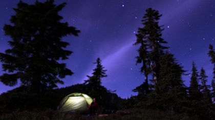
That night we made it back to Marble Mountain Sno-park. I recall stumbling up to the trailhead and seeing the same pattern of stars that were in the night sky when we had set off that morning. My legs and feet were exhausted, one boot felt loose due to an untied lace, stomach was demanding food, mouth was dry from running out of water hours earlier, but I was satisfied knowing that we had completed our mission, our goal, our third attempt on the summit of Mt. St. Helens.[/vc_column_text][/vc_column][/mk_page_section][mk_page_section bg_image=”https://wanderlusthiker.com/wp-content/uploads/2015/02/010687392e45914d2fd149d6cc1b59c277f470e4a2.jpg” bg_position=”center center” bg_repeat=”no-repeat” bg_stretch=”true” full_height=”true” full_width=”true”][vc_column][vc_column_text] [/vc_column_text][/vc_column][/mk_page_section][mk_page_section][vc_column][mk_fancy_title tag_name=”h1″ font_family=”none”]
Additional Resources
[/mk_fancy_title][vc_column_text]Climbing PermitsMount Saint Helens
- USDA – Mount Saint Helens Climbing Update
- USDA – Climbing Mount Saint Helens
- Mount Saint Helens Institute – How to Prepare for Your Climb
- Portland Hiker’s Field Guide – Mount Saint Helens Hike
- Wikipedia – Mount Saint Helens
- Wikipedia – 1980 Eruption of Mount Saint Helens
Climber’s Bivouac Trailhead to Ptarmigan Trail
Marble Mountain Sno-park to Worm Flows
Food Preparation for Winter Hiking
[/vc_column_text][/vc_column][/mk_page_section]


Good work you obviously put a lot of effort into this post! Look forward to seeing more.
Thanks, Chris!