4 Reasons Why the Dangerous Beauty Award Goes to Siouxon Loop
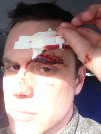
Warning: The following article contains images of wounds and blood that may be unsettling to some. Viewer discretion is advised.
Maybe you thought multi-day backpacking was as easy as wedging beef jerky in your shorts and bungee cording an old Coleman tent to your belt. Well, yes. If you want to hate yourself. Strolling through the wilderness singing Disney songs with the birds is best accomplished with solid gear choices to make the trip go smoothly and knowledge of the trail you will be hiking.
There are a lot of approaches to backpacking. Truly the only wrong approach is the one that kills you, but ultimately it comes down to balance between comfort and survival. Case in point: Siouxon Loop.
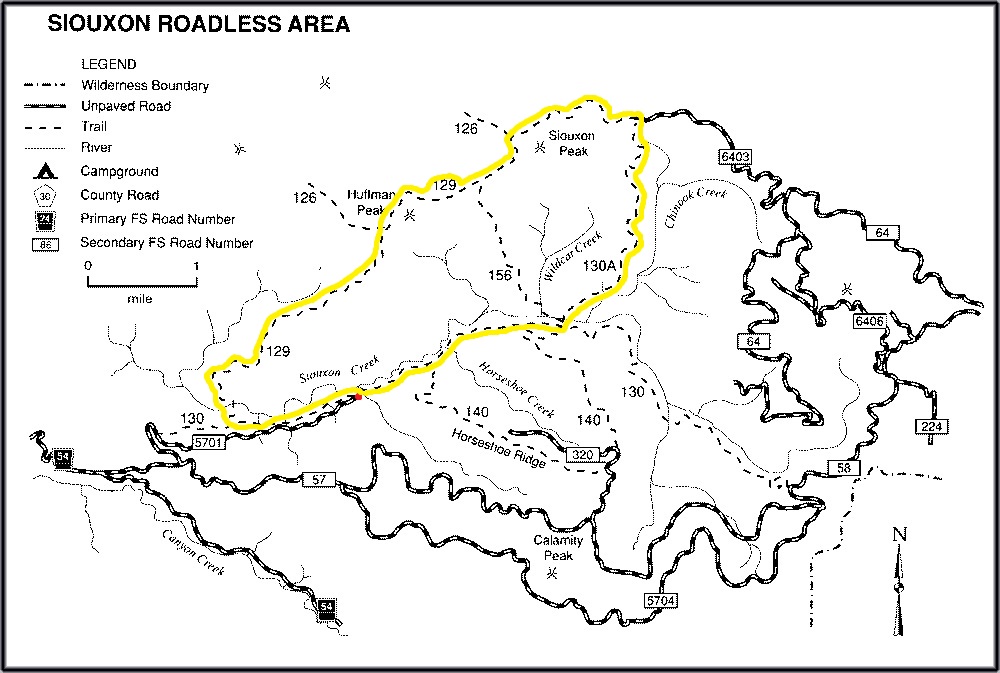
‘Siouxon Loop’ (Sou-sawn) is the term unofficially assigned to the series of trails which begin and end at the Siouxon Creek trailhead. Siouxon trail 130 heads east to Chinook Creek trail 130A, which goes north to Siouxon Peak. Following trail 129 to Huffman Peak eventually goes back down to Siouxon Trail 130, completing the loop.
It’s beautiful to the extent that all leafy, green things are in the Pacific Northwest, but Siouxon Loop exemplifies it in its own unique, sometimes dangerous, way.
#1 – Winter will freeze everything
Back when I was still a backpacking n00b I decided that a trip to Siouxon Creek in the middle of winter was a novel idea.
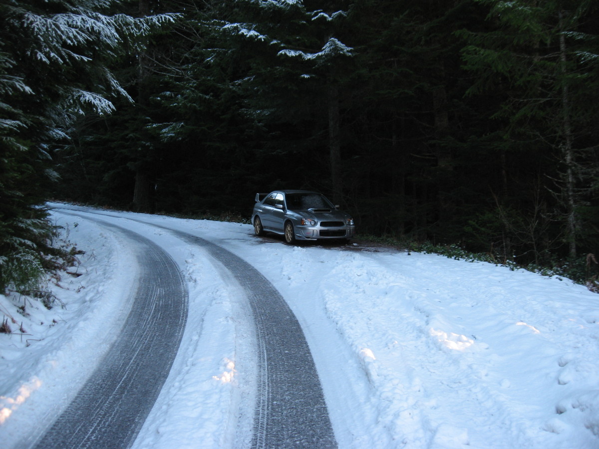
The road to Siouxon Creek trailhead is mostly unmarked, narrow, curvy, and has varying elevation grades. Back roads can be dangerous enough on a warm, summer day but when you dump snow on them and lower the temperature into the teens they become bobsled trails.
Everything is frozen at these temperatures. Oh, that wood looks dry! Nope – It’s not. Hidden between the fibers are tiny crystals of ice that formed after the wood soaked up all that moisture during the rainy season. And in Washington we love a good rainy season.
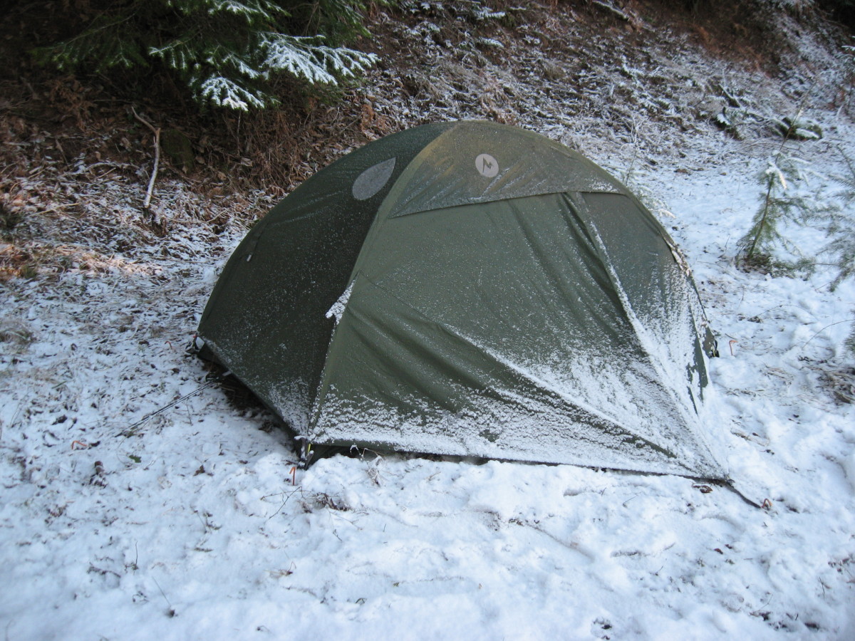
That snow looks soft! Just kidding – It’s an illusion. After the temperature drops significantly past freezing that soft, fluffy white powder that’s been sitting for days forms a hard base layer. Even if you find a patch of dirt not covered in ice, you do not want to sleep on the frozen ground without a solid layer of insulation between you and the floor of the tent. The ground will sap the warmth from your body like a big, earthy mosquito.
I did not make it to Siouxon Creek that winter. Instead I set up camp on the side of a hill over looking Calamity Peak road and tested out my cold weather gear. My fingers still get numb just thinking about it.
#2 – Don’t fight the streams
Spring was here and I was ready to hit the trail like a boss. About an hour in, with a granola eating grin on my face, I waved merrily to some USDA workers who were on an overnight trip to fix a bridge that spans Siouxon Creek.
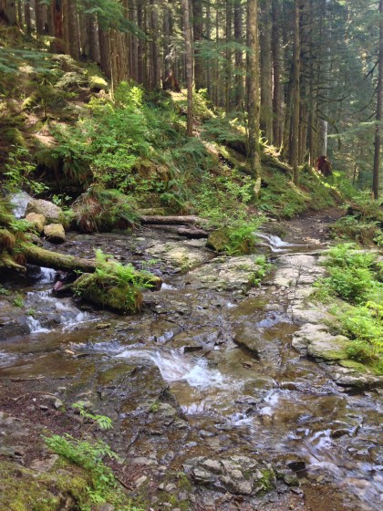
Immediately before this bridge is a stream that runs gently down the side of the valley into Siouxon Creek. The trail appears to go directly through it. With the water only an inch deep the thought will cross your mind, “I bet I could just tip toe across this silly little stream and be on my way!” The squirrels will be watching and you will feel the pressure of their eyes.
Patience is key at this point. The correct move is to stop and take your pack off. Do not attempt to cross. Maybe eat a Snickers first and admire the beauty of running water. If you walk a few yards uphill along the stream you will see some wooden logs that have been arranged in a bridge-like fashion. This is where you should cross. Being very careful, of course.
With every “choose your own adventure,” there is a wrong choice. The stream intersects with Siouxon Creek at about 4 miles out from the trailhead. The bridge is clearly visible just a few yards away. And, shoot! An inch of water is what puddles on the playground are made of, right?
With the kind of hazy, hikers-high logic that you get after only a few miles in to a trail without rest, I took a step forward. My worn out Brooks running shoes winced as the water hit the thin sidewalls. My intention was to test the grip of the rocky stream bed with one foot first to see if it was passable. Suddenly, as if the law of friction had been temporarily suspended, my left foot slid sideways and backward causing my top heavy body to fly forward. I landed first on my hands with my palms out but the momentum generated by my grossly overweight, 60 pound backpack caused my head to pitch forward and slam sickeningly into the solid, flat rock just an inch below the water’s surface.
Cold. Numb. Wet. I recall laying in the stream for a few seconds before finally pushing myself back up and out on to the dry dirt. My hand wandered to my forehead and felt a massive gash above the left eyebrow. My forehead, on the other hand, didn’t feel a thing. I quickly dropped my pack and scrambled for the limited number of first aid supplies that I had very wisely decided to carry for the trip. Although I hadn’t been knocked unconscious from the fall, I nearly passed out when the result of the impact was reflected back in my hand mirror. After taking a few deep breaths I performed gentle cleaning with purified drinking water, dried the area with a paper towel, then taped a few large bandages over the wound.
Furious at my miscalculation, I packed my bag hastily and trudged back towards the trailhead. On my way, I ran into the USDA team that I had passed on the trail earlier. One of them had been maintaining trails in the region for over 20 years. He told me that the wound on my face was the worst he had ever witnessed in the wilderness.The duo very graciously patched me up and recommended that I get medical attention immediately. The senior of the two escorted me back to the trailhead to ensure I didn’t collapse somewhere on the trail.
Failure is a result of mistakes that, in hindsight, might have been prevented. That day it was clear that one step in the wrong direction could be perilous. On the drive out, I vowed to return and conquer not only Siouxon Creek but the twin peaks that watch over it.
#3 – No water in the hills
Roughly a month later – stitches removed, swelling subsided – I set out again to complete Siouxon Loop.
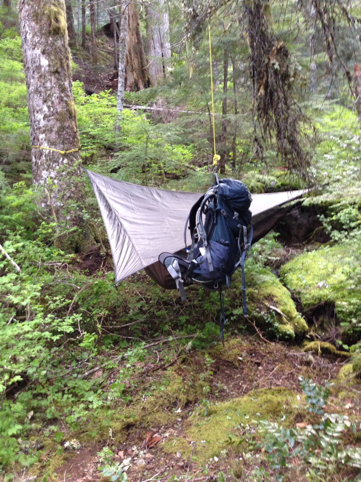
I had lightened my pack from 60 to 30 pounds, which made an extraordinary difference in mobility. Lighter, smaller materials were used for various pieces of equipment; including a brand new Hennessy Explorer Deluxe Asym Classic Hammock as a tent replacement. I carried less water and instead relied on natural water sources to stay hydrated. Food revolved around light weight, high calorie selections like freeze dried meals and energy bars.
For obvious reasons the trail that follows Siouxon Creek allows for a virtually unlimited supply of fresh water. It isn’t until you leave the valley that you enter a dry zone. The section of trail that extends from Siouxon Creek to road 6403 has a handful of tiny streams. I was hiking in the spring and most of them barely yielded a trickle.
Fortunately, I found a small, steady stream running down the side of the hill that I used to replenish my water reserves. In it’s natural state, traditional camping in this spot would have been virtually impossible due to uneven terrain and overgrown vegetation. The SOG F09N-CP 420 stainless steel hand axe made short work of the vegetation and the new Hennessy hammock floated harmlessly above the jagged ground. This became my campsite on the first night.
The next day I trekked through the hills and marveled at the view from Siouxon and Huffman peaks. The hike was relaxing and therapeutic but I did not encounter any sources of water. As I headed down trail 129, from Huffman Peak, I was optimistic that I would come across a small stream or two. This did not turn out to be the case. The next time I would see water would be later that day when the only two options for getting back to the trailhead were go back along the trail I had just hiked or cross Siouxon Creek.
#4 – Crossing Siouxon Creek
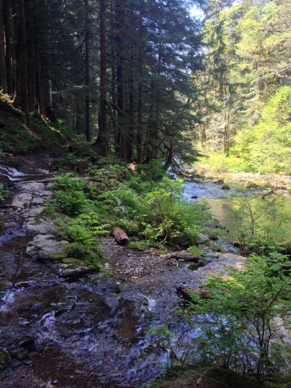
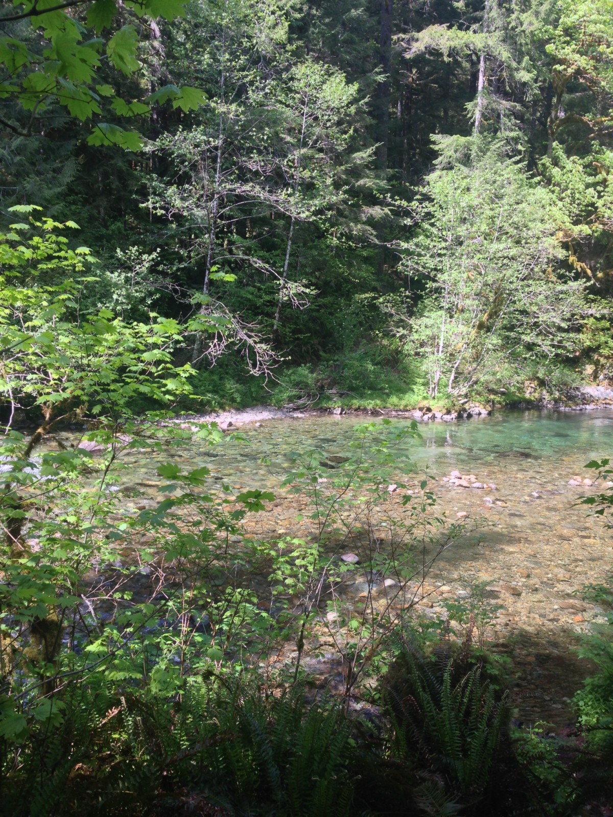
10 miles ago I had climbed out of the valley, trekked over two peaks, and now my imagination was running wild with the different scenarios in which I could die as I stared morbidly at the relatively calm water of Siouxon Creek. A few yards away a severed cable tie lay forlornly on the sandy bank. It was sunny and hot and the water looked inviting. But after my experience with a separate, seemingly insignificant stream I was feeling apprehensive.
I dropped my pack by the side of the creek and stripped my sweaty shirt clean off, tossing it forcefully at my backpack as if it prove some kind of point. The pack didn’t respond. I shrugged and stared upstream a ways to see if there was a secret bridge that would magically appear. The severed cable tie may have been a suspended bridge at one point, but now it was about as useful as a boat without a paddle. Quite certain that a bridge did not exist and that, based on my research, the only way to make it to the other side was in fact to ford the creek, I began investigating where the lowest points were located.
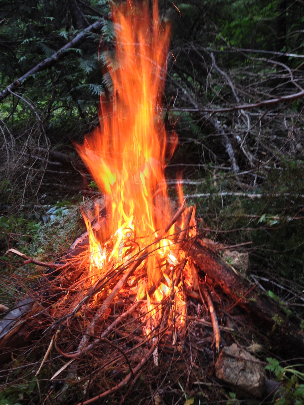
I dipped my hand in to the water to feel the smoothness of the rocks below the surface. The temperature was cold, but not freezing. It wasn’t the kind of bone chilling frigidity that will cause your organs to shrivel. In preparation I rolled up my pant legs and tied my shirt around my head. This worked partially as a bandanna to keep the sun out of my eyes and as a cushiony buffer in case any rocks attempted to smash my face. I did not remove my shoes because I knew tonight would be my final night in the wilderness and that I could dry them, along with my socks, over a toasty fire. With my pack loosened and the waist strap unclipped, I grabbed my trusty walking stick and stuck one shy foot into the creek.
The bottom turned out to be sandy and littered with large rocks, which is nearly perfect for water crossings. This kind of surface is solid, yet flexible and forgiving. The deepest point measured between 2-3 feet with the water hitting just below my hips.
Slowly I made my way across the creek and, before I knew it, was on the other side. The bank was steep and the trail was not easily identifiable. I ended up hiking a ways upstream looking for a clearly defined route. What I eventually found was much closer to the point where I had originally crossed and was a steep, narrow path that led up to a very tidy, waterfront campsite.
—–
The struggle was real. It’s generally not a good idea to go backpacking alone. If you are intent on risking it all in solitude then so be it. But ensure that you are extra prepared and exercise extreme caution in committing yourself to even the simplest of actions if you do. Nature does not care if you live or die within its confines.

