31 miles, 6,568′ elevation gain, one day? We’re in ultra marathon territory here.
A small number of people will decide to hike the trail around Mt. St. Helens as part of a multi-day backpacking trip. An even smaller number will attempt to run it in a single day. For that rare breed for whom “basic” is not in their definition of self this trek is a coveted achievement.
If you’re here than it means you either have a morbid curiosity about what it takes to push your body through 31 miles of varied terrain and +8,000 calories of raw energy burn or you are genuinely seeking additional information about how to support your own adventure. The following is a compilation of information designed to assist you.
For additional weather information please look at the following resources:
Trailhead Status
Check June Lake trailhead status before heading out.
Road Closures
The USDA reports updates on road status on Mt. St. Helens’ south side:
Runners should be aware of the elements of risk associated with attempting to run around Mt. St. Helens via Loowit trail in a single day. While some dangers are more likely to occur during particular seasons it’s important to be familiar with each type and how to avoid, prevent, or mitigate the risk associated.
Boulders
What is it?
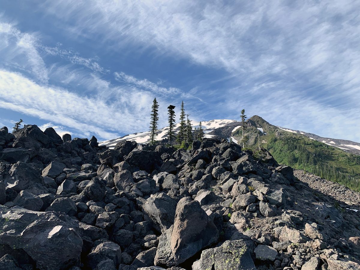
- In 1980 the mountain erupted with an explosive force equivalent to 24 megatons of TNT creating a crater 1 mile wide and launched huge chunks of rock across the landscape.
- These larger boulder fields are marked with wooden poles to indicate the trail but it can be difficult to navigate in heavy fog.
How can it be mitigated?
- When crossing the boulder fields be aware of your footing and step carefully.
- Carry a device with waypoints or GPS coordinates in case you get lost.
Streams
What is it?
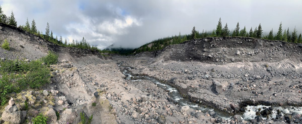
- Glacial run off from Mt. St. Helens has created rivers and streams that crisscross the landscape.
How can it be mitigated?
- Look for stable rocks and/or wood logs that can be used as a bridge.
Ropes
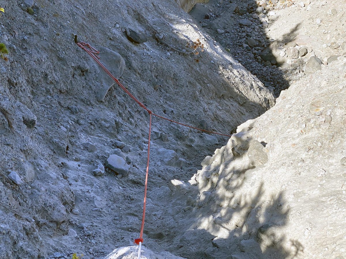
What is it?
- On the west side of Mt. St. Helens near the Toutle River there are often ropes setup to assist with the climb down and out of the canyon.
How can it be mitigated?
- Move quickly, carefully and efficiently along the rope.
- Yield to uphill traffic while descending.
- Wait behind slower climbers, don’t pass unless they give you the OK.
- Travel single file.
- Be patient.
- Be polite.
Dehydration
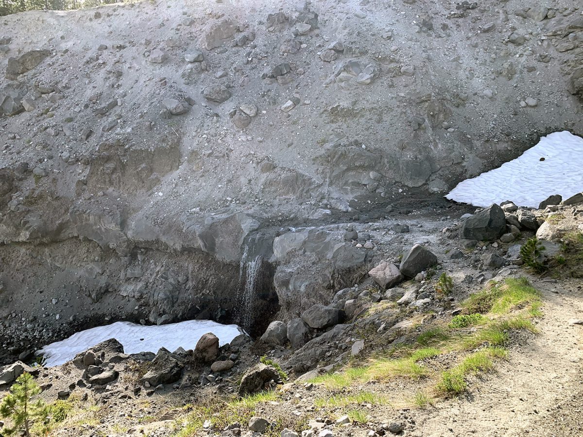
What is it?
- Dehydration occurs when you lose more fluid than you are taking in, and your body does not have enough water to carry out its normal functions. It can be dangerous and impair your ability to move or concentrate.
- It can result in less frequent and dark colored urination, fatigue, dizziness, and/or confusion.
How can it be mitigated?
- You should start hydrating the day before strenuous exercise.
- Producing lots of clear urine is a good indication that you’re well-hydrated.
- During the run be sure to replenish fluids at regular intervals and continue drinking water after you’ve finished.
Exhaustion
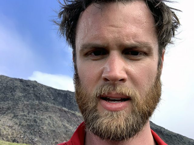
What is it?
- Exhaustion exists on a spectrum and can have many causes, but specifically we’re concerned about physical exhaustion.
- This is the point in which your body is beginning to send your brain messages that it can no longer continue the activity you’re doing.
How can it be mitigated?
- Training beforehand for the event helps to condition your body for strenuous activity.
- Run the flats and downhill sections.
- Walk uphill or loose terrain sections.
- Conserving energy by exerting where necessary but retaining some for the long term goal.
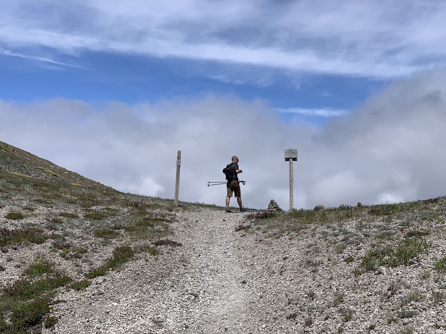
You might be asking yourself – is this even possible? Yes, it is and with training you can do it.
I would not recommend attempting to circumnavigate Mt. St. Helens along Loowit Trail in one day without understanding your own bodily limits first. Start evaluating your personal metrics on a smaller scale. For example:
- How do you feel after 5, 10, and 20 mile hikes in a single day?
- How do you feel after 4, 8, and 12 mile runs?
- What was your average pace after a period of time running/hiking?
- How much weight were you carrying for that distance and period of time?
- How much food and water did you consume vs how much you felt like your body needed to consume?
- What were the conditions like during different activities that may have contributed to quicker exhaustion vs prolonged energy? i.e. hot vs cold, wind/rain/snow
- What was the environment like? i.e. pavement vs loose terrain, elevation gain/loss
Knowing the answers to these questions and experiencing how your body handles the stress of prolonged exercise will take you a long way to being prepared to do this trail in a single day.
Pace
Loowit Trail is roughly 31 miles in length if one starts from June Lake trailhead. In order to finish the trail in exactly 24 hours one would need to average 1.3 miles per hour (or a 46 minute mile). Most people likely do not want to trail run in the dark though, so let’s assume an ideal, sunny day in August where the average daylight period is about 14 hours. If one were to start from June Lake trailhead at sunrise and plan to end at sunset they would need to keep an average pace of 2.2 miles per hour (or a 27 minute mile). The question to ask yourself is can you hit or do better than that pace for 31 miles over an established, mixed terrain trail with 6,568 feet of total elevation gain?
Know The Terrain
If you have never backpacked Loowit Trail around Mt. St. Helens before, do that first. Plan out 2-3 days where you tackle sections of the trail each day with a fully loaded backpack. This will give you a sense for which sections of the trail make sense to run vs walk and which sections have water crossings and climbs. Experiencing the route beforehand will allow you to identify landmarks which will help you to know how far you have to go and which places to push and/or move quickly or potentially slow down to conserve energy. Another advantage this will provide is with identifying water sources. By having been to a location you will know exactly where water sources live than trying to find them on a map and hope they are not dry.
The Risks
If you have underlying health conditions you should consult a doctor before attempting something this strenuous. Even people who are in great health will be challenged by doing this route in a single day. If you’ve had bodily injuries be aware that you may be at risk of reinjuring yourself and that if you are stuck on the trail it will be a long trek back out.
Starting from June Lake Trailhead
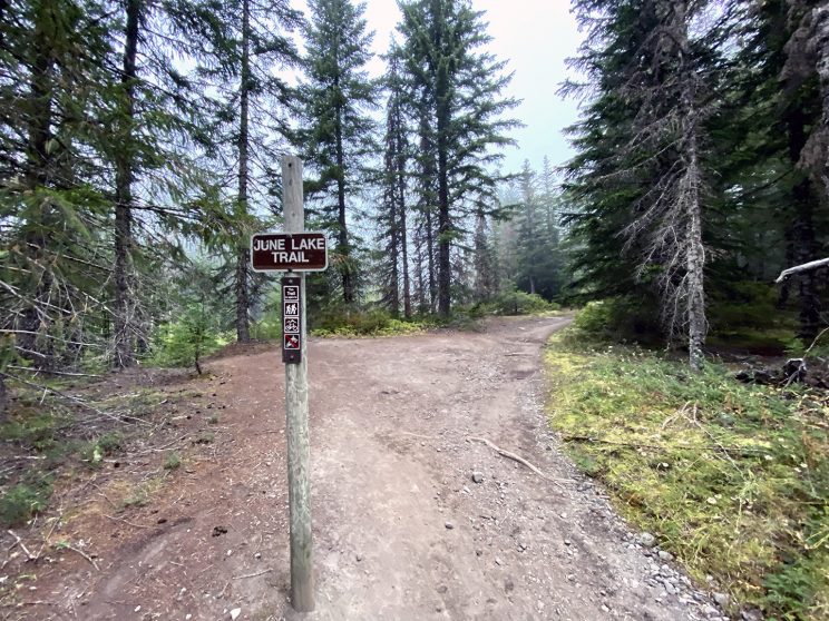
Beginning a single day circumnavigation around Mt. St. Helens is best accomplished starting from June Lake Trailhead as it is the most easily accessibly by car and has the shortest distance to Loowit trail – which is the actual trail that you will follow to complete the loop.
A typical schedule for a single day, clockwise run of Loowit trail might look like this:
- 7:00 AM – Arrive at June Luke TH (2,750′).
- Organize gear and eat a light snack.
- 7:10 AM – Depart the parking area.
- 7:30 AM – Mile 1.5 – Arrive at Loowit Trail junction (3,410’).
- Steady upward climb with a few flat spots, you may choose to walk/warm up on this section or do a light jog.
- 7:50 AM – Mile 2.6 – Arrive at Wormflows climbing route junction (3,700′).
- Continued upward climb with a boulder field to cross.
- 8:30 AM – Mile 4.5 – Arrive at Monitor Ridge climbing route junction (4,688’).
- Continued upward climb before leveling off at the end of this section.
- 9:00 AM – Mile 6.7 – Arrive at Butte Camp junction (4,794′).
- Flat section great for higher speeds.
- 10:15 AM – Mile 10.6 – Begin descent to Toutle River (4,707′).
- Mix of flats and dips with a final long descent.
- 10:45 AM – Mile 12.6 – Arrive at Toutle River (3,159′).
- Re-fill water and eat a light snack.
- 12:00 PM – Mile 16.0 – Arrive at Studebaker Ridge (4,017′).
- While traversing the northern section you may encounter several streams but most will be silty.
- 2:10 PM – Mile 21.4 – Arrive at Windy Pass (4,864′).
- Mix of flats and dips with a general upward climb.
- This is the highest point on the trail, you will likely be feeling quite tired and questioning your life choices.
- 3:30 PM – Mile 24.2 – Arrive at Ape Canyon trail junction (4,219′).
- The Plains of Abraham are mostly flat with a general downward direction.
- 5:30 PM – Mile 29.5 – Arrive back at June Lake trail junction (3,410′)
- Slight climb at the beginning of this section but then it’s all down hill – however you will have a boulder field to cross.
- This is where it will really start to hurt.
- 6:30 PM – Mile 31.0 – Arrive back at June Lake TH (2,750′).
- A gentle downhill traverse where you will relish the sight of vehicles indicating you have completed the trek.
A trail run around Mt. St. Helens can take 10 hours or more depending on your abilities. Someone who has prepared properly can average 1 mile every 20 minutes, at that rate it will take about 10 hours and 20 minutes to complete the loop.
A start time should be established based on an estimated pace and your desired completion time. Timing is more flexible during the summer month because there is more daylight and the weather is typically more suited for trail running, however it is possible to have unexpected rain or snow storms roll through the area. Runners who are in good shape and have trained to run on loose terrain can estimate less than 10 hours to complete the loop. Others should prepare for a longer trek, maybe 12 – 14 hours.
The trailhead is well marked and the trail around the mountain has significant signage. However, if you are unsure of where to go play it safe and follow others or pay close attention to the worn path. Typically in the summer Loowit trail sees a lot of backpackers and day hikers which means there will be opportunities to talk to other climbers to get your bearings in case you get turned around. In conditions with poor visibility or a freshly snow covered trail you should consider using a GPS or map and compass to ensure that you are on the right track.
The terrain can vary from forested scenery with a dirt trail to open boulder fields to exposed ash, pumice, and loose rock. While on the other end of the spectrum the trail can be buried in snow and ice in the early spring and late fall months. Runners should evaluate what conditions will be like prior to their climb and bring the appropriate gear. As many experienced runners will attest there is a stark difference between running on a dry trail and running in slush and snow. During Spring and Fall you may need to be prepared for a mix of everything.
Clockwise or Counter-clockwise?
Navigating clockwise allows you to hit the biggest gain/loss of elevation on the trail early on. This section is the descent/ascent in the Toutle River canyon. It really depends on personal preference.
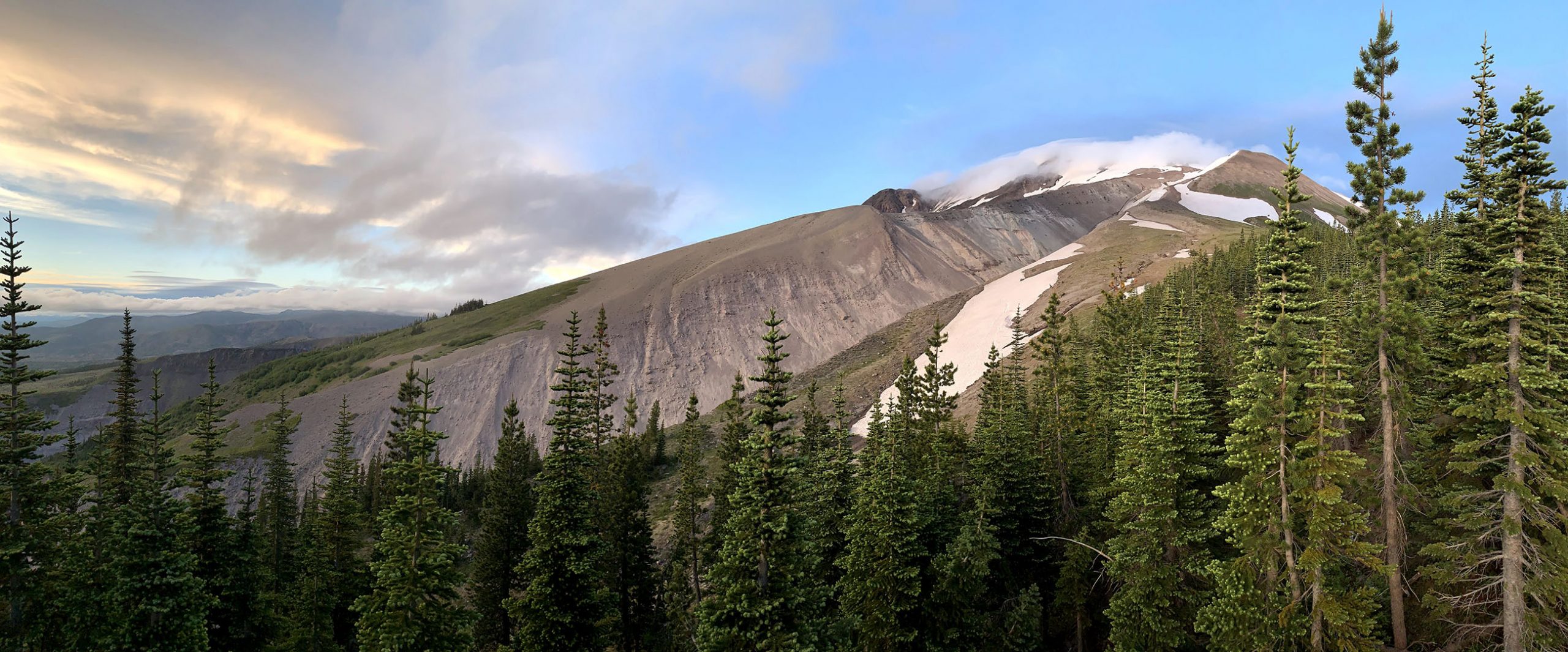
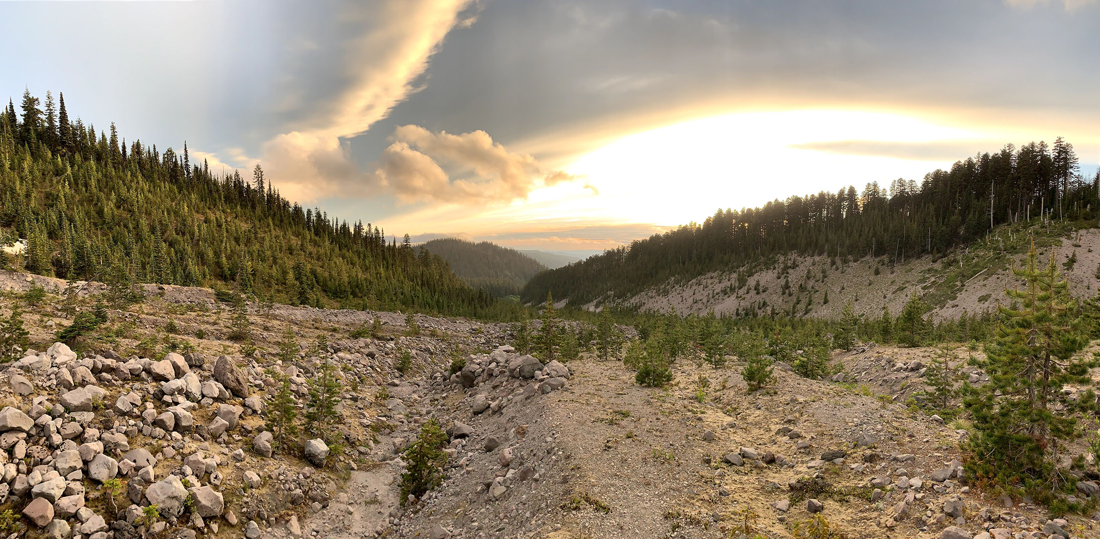
The best time to trail run around Mt. St. Helens is between the months of June and September. The biggest natural barrier to completing the loop in a day is weather and snow pack. Picking a date to run all depends on your preference and risk tolerance. Questions to ask yourself:
- Do you want to run on dry ground or snow?
- Do you want isolation or a more populated trail?
- Do you want to carry more or less gear during the run?
- Are you prepared for hot/cold, wet/dry or clear/cloudy weather?
Average Temperature (°F)
Source for maximum and minimum temperature data came from USDA NRCS June Lake, WA (3,440′) SNOTEL. A date range of 1/2011 – 12/2015 was used to calculate 5 year averages by month.
Average Precipitation (in.)
Source for precipitation data came from USDA NRCS June Lake, WA (3,440′) SNOTEL. A date range of 1/2011 – 12/2015 was used to calculate 5 year averages by month.
Lodging
The nearby town of Cougar, WA is home to the cozy & rustic Lone Fir Resort and the mom & pop-run Monfort’s Bed and Breakfast. Other lodging options might be found on AirBnB. The town of Cougar, WA is only 30 minutes drive from Climber’s Bivouac.
Other may prefer to stay at a more traditional hotel in Woodland, WA. It’s a longer 1 hour drive to Climber’s Bivouac, but the town is immediately off of interstate 5 and is only 30 minutes from Portland International Airport.
Camping
June Lake trailhead does not have any official camp sites, but there are plenty of spots in and around the general area where people have been known to car camp.
Mt. St. Helens climbers will often choose to camp at either the Climber’s Bivouac or Marble Mountain Sno-park. Camp spots are limited and availability is on a first come, first served basis.
If the trailhead campgrounds are full, no worries. Gifford Pinchot National Forest has many camping opportunities that are only 5-10 minutes drive from these climbing start locations. Many open camping spots are located off of national forest road 81, with the most popular sites being near Merrill and Yale Lakes.
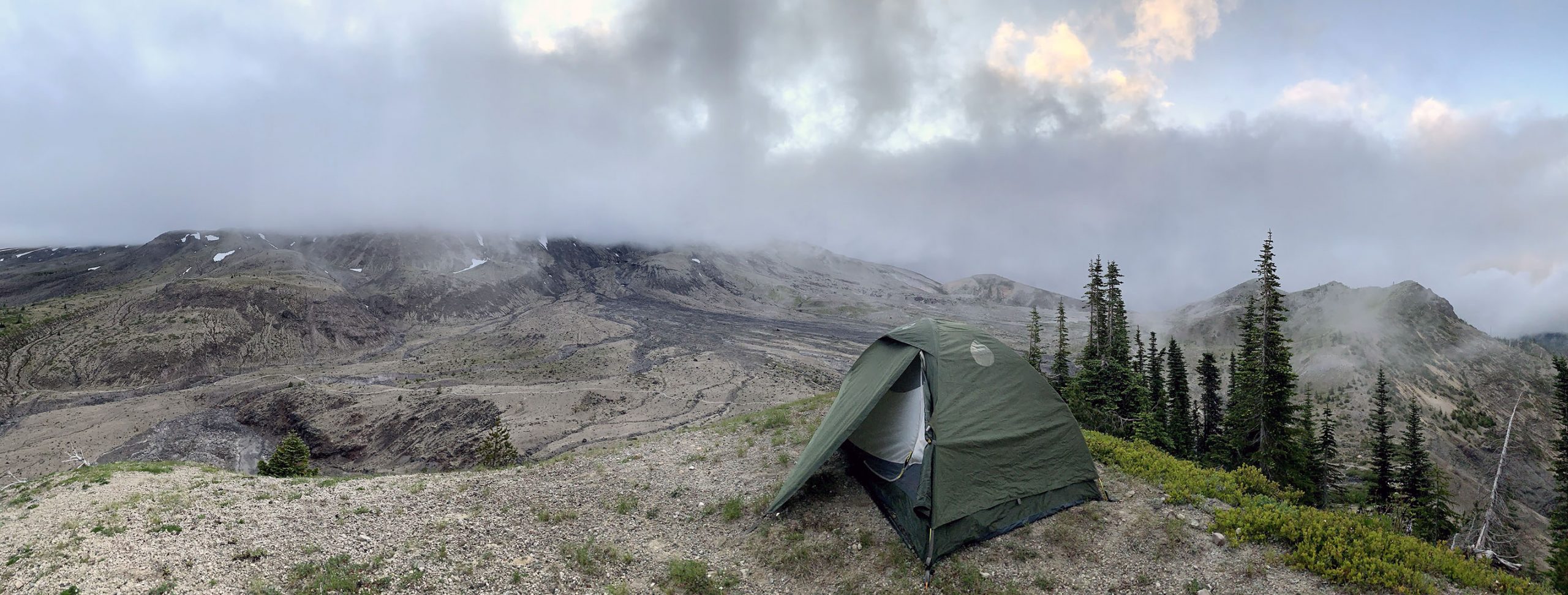
If you’d like a longer stay on Mt. St. Helens, you may also camp on the mountainside. If you choose to camp above timberline, be sure you are off the trail and practice good camping etiquette. If you pack it in then pack it out.
You may need to adjust the driving route depending on your exact start location. June Lake is the most common start location.
Lewis River Road (Rd 90) and NF-83 are generally open year-round, but the road to June Lake may become gated off during the winter months. The section of NF-83 just past Marble Mountain Sno-Park is usually gated when heavy snow arrives in the area. Always check Current Conditions before heading out on a trip.
| Required | Optional |
|---|---|
| Clothing | Gaiters |
| Food | Trekking Poles |
| Water | Sun Protection |
| Navigation | Mobile Device |
| First Aid Kit | Head Lamp |
Required versus optional gear selections are based on a minimalist, light weight approach to trail running around Mt. St. Helens that aims to include the essentials to decrease risk and while cutting as much weight as possible. You should always evaluate what gear to bring based on current conditions and your overall risk comfort level.
A small, trail running pack is required in order to transport the recommended items. Typically these are ultra-light, vest-style backpacks that keep storage as close to the body as possible to balance weight distribution and maximize versatility while running. There are many low cost packs available and there are also more premium, brand name products which tend to have a higher cost. If you’re new to trail running we recommend starting low cost to get an idea of what works for you and then graduate to a more customized/personalized pack that meets your specific needs.
To start – we tried the Aonijie 5.5L backpack. At $30 it’s a bargain compared to the $140 Salomon Advance Skin running vest (2021 prices). There is very little to complain about with the Aonijie – it has space for a 1.5 – 2L capacity water bladder, clasps for the hose out front, modular storage front and rear, adjustable straps for the right fitment. Most important, when it’s fully loaded and straps are adjusted properly it does not hinder running performance. The only negative is that the rear zipper can snag and the zipper itself feels like it might break when stuffed full, but the rest of the pack feels solidly constructed even if it is light weight materials.
If you need more space the Osprey Duro 15 might be for you. With 15L of capacity that’s nearly 3 times the carrying volume of the Aonijie but the trade off is increased weight (1.17 pounds). The design appears well thought out and includes a hipbelt for increased stability.
Clothing
You should anticipate the highs and lows for temperature, cloud cover, and precipitation on the day of your run. Remember: You can carry more layers but this may negatively impact your endurance and pace. Your clothing strategy should be a tailored solution to the environment you’re expecting – with an emphasis on lightness because the goal is agility and speed.
Shoes – First and foremost a quality pair of trail running shoes that you’re comfortable in for long periods of time is required. Considering the amount of abuse that your feet will experience selecting a shoe that is both comfortable and supportive is crucial. My favorite trail running shoe has been the Altra Lone Peak 4 Mid RSM because of how much grip they provide in an low weight package.
Socks – Arguably one of the most important selections behind shoes. Your feet will be taking a beating so ensuring that they stay both warm and cool at the right times as well as dry and comfortable. Over the years I’ve become a big fan of the products by Darn Tough. Their 1/4 lightweight sock is strong and breathable for hot days and their 1/4 cushion sock is the best all around sock for when it’s colder or you need a bit of extra cushion.
Underwear – The true base layer. This layer is just as important as the others and will ensure that your private bits stay comfortable as you’re sloshing about for 31 miles. ExOfficio is here to save the day with great products for men and women that are quick drying, breathable, comfortable, supportive, prevent odors, and allow ultra mobility.
Pants/Shorts – More often than not shorts will be your best option, especially for running. The best solution I’ve found is the PrAna Zion convertible pant which allows the legs to be detached and converted to shorts as needed. It’s also very warm, while also be fast drying and moisture wicking. Added bonus it has a bunch of little pockets which comes in handy when you’re carrying a trail running pack that’s less than 10 liters.
Shirt – This is the base layer that you will be spending the day in. It should allow for a great range of mobility, moisture wicking, fast-drying, and provide initial protection against the elements. There are many great outdoor companies with a wide variety of shirts to choose from. I’ve always had great success with Mountain Hardwear’s shirts, like this one.
Jacket – This is your emergency or Plan B layer when things start to get a bit chilly or you encounter precipitation. This should be an ultralight pre-shell layer, such as this Mountain Hardwear KOR jacket.
Gloves – Not required, but I found having a lightweight pair of gloves to be useful for a couple reasons. They can keep your hands warmer for the chillier sections of the trail, provides natural sun protection to the hands on sunnier sections, and also decrease hand blisters if paired with trekking poles or when climbing over boulders. Mountain Hardwear used to make a fingerless glove which had a lightweight mitten attachment for additional warmth, but their other gloves work great too.
Hat – Either a beanie for warmth or a hat with a bill/brim/visor to keep sun out of your eyes on warm, bright days. Columbia has a great line of mesh hats for exceptional cooling and sun protection.
Eye protection – A pair of lightweight sun glasses will save your eyes from a full day of UV light and will reduce strain from glare. Maui Jim provide a quality solution.
Food
Eat before, during, and after the run. Load up on fats and proteins the day before the run as these metabolize more slowly and will give you energy for a longer period.
During the run snack every 20-30 minutes on high carbohydrate foods as these metabolize faster and give you quick bursts of energy. Eating at least one or two snacks per hour avoids large spikes in energy and helps maintain smooth, consistent energy levels. Keep in mind, roughly 120-200 calories can be burned every 15 minutes depending on your base metabolic rate, speed, grade, and air temperature. This is nearly double the rate of calories burned during mountain climbing. For a 10 hour run that’s somewhere between 4,800 – 8,000 calories. That’s a tremendous amount of energy and is the equivalent of between 17 – 28 regular sized 280 calorie Snickers bars, which apparently you can buy in bulk.
It’s also important to be aware that while you’re burning several days worth of calories in a matter of hours you may start to get cravings for certain foods. Sometimes it’s a big juicy burger… or a hot pizza… or a double order of pho. Either way you should be prepared with some snacks that will help satisfy those cravings. This isn’t the time to pick strictly healthy foods. Your body will be demanding racing fuel.
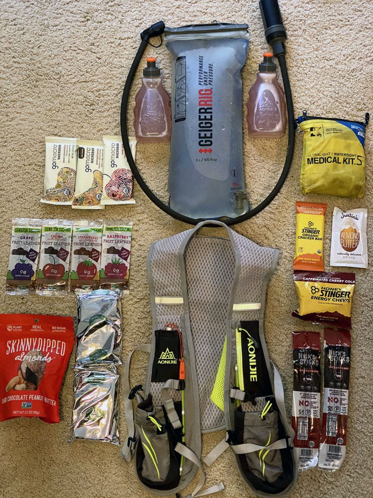
Here’s what I brought on my run:
- 3 GoMacro bars: 200 + 250 + 280 = 730 calories
- 4 Stretch Island Fruit Leathers: 50 ea = 200 calories
- 2 Nature’s Path Toaster Pastries: 420 ea = 840 calories
- 1 Skinny Dipped Almonds bag: 525 calories
- 1 Stinger Bar: 220 calories
- 1 Justin’s Almond Butter packet: 200 calories
- 1 Stinger Energy Chews bag: 160 calories
- 2 Acli-Mate sport drink packets: 30 ea = 60 calories
- 2 Nick’s Sticks: 120 ea = 240 calories
Total = 3,175 calories
The problem is this is not enough calories to prevent a deficit of energy in the body. This is why it’s important to frontload a big chunk of calories prior to the run starting the day before but you don’t want to eat any thing too heavy. It should be nutrient and calorie dense without giving your body that bloated, weighty, lethargic feeling. This will vary depending on your body and nutritional needs. The night before I will eat a dinner (+1,500 calories) with a lean meat, vegetables, and either rice/potatoes. The day of the run, for breakfast (+500 calories), I will eat oatmeal or a calorie dense cereal/granola with some kind of sports drink.
After the run, eat foods that are high in fats and protein which helps muscles recover from lots of exercise. Remember your metabolism keeps going for several hours after you stop, so that’s the time to binge a little and refuel. This is when it’s OK to get that double order of pho.
Water
Science recommends 1 liter of water be consumed for every hour of high energy activity. For a trail run like this that would be 10 – 14 liters (or 2 – 4 gallons), which is the equivalent of 17 – 33 pounds of weight on top of all the other gear you would be carrying which is not feasible or recommended.
Similar to food – we recommend the before/during/after strategy. Days before the run be sure to keep your body extra hydrated. The day of the run drink 2-4 liters of water a few hours before you start your run to saturate your body and reach your muscles. For the actual run, bring 2-3 liters of water to sip on constantly.
A water bladder makes constant hydration much easier, we recommend the Aquamira pressurized hydration reservoir (previously Geigerrig) for its durability, light weight and ease to refill. It comes with an in-line replaceable filter so that you can refill from sources of water along the trail, which will be important because you will need to supplement water in order to prevent dehydration.
Another important tip to keep in mind is that hydration is not all about water – it’s about the minerals, vitamins, and nutrients in the water as well. As you exercise and sweat you lose a lot of these important minerals which purified water cannot necessarily replenish on its own. A powdered sports drink like Acli-Mate can re-add these while also adding a satisfying flavor to your drink. Bring a small, lightweight bottle to mix 8oz (or 1 cup) of water with the powdered drink mixture and you’re all set. Many small, trail running backpacks come with these small bottles designed specifically for this purpose.
After the climb, have a gallon of water waiting in the car to replenish your reserves and then continue to drink plenty of water in the following days.
Navigation
Know the route. Even though Loowit trail is well marked, sections of the boulder fields can sometimes be difficult to navigate.
Weather can change rapidly and white out conditions can descend on the mountain quickly. Having and knowing how to use a map, compass, and altimeter can keep you on course. Using a GPS with waypoints can be helpful.
We recommend the AllTrails app because you can download offline maps with GPS tracks. You probably already have your phone with you and the subscription is often cheaper than most standalone GPS services.
First Aid Kit
You or at least one runner in your group should carry a medical kit from which they can dispense first aid to themselves or others, but you should never depend on another runner or hiker to be able to patch you up. Adventure Medical sells a great, light-weight kit that we bring on every outdoor trip – whether it’s hiking, climbing, or running.
For trail running we highly recommend carrying an elastic compression wrap or an ACE bandadge in the event of an ankle or foot injury. Trail running increases the risk of ankle sprains and breaks as a result of uneven and loose terrain. Having one or two of these bandages can provide the support you need to make it back to the trailhead in the event of a debilitating injury. We know because we’ve been there.
Gaiters
Gaiters cover the vulnerable tops of your footwear to fully protect your feet and lower legs from the snow, water, dirt and rocks that have a way of sneaking into even the best boots and shoes. Altra makes a minimalist gaiter for their running shoes that can be useful for especially mucky trail runs.
Trekking Poles
As we’ve lamented on other trips, trekking poles are extremely advantageous to have, especially on mountains. They do more than just provide stability. Trekking poles actually transfer load away from your legs. This is most noticeable on downhill sections where your knees are most likely to take a beating. An affordable pair of trekking poles will do the trick, however if you’re feeling the need to go ultra-light Black Diamond makes a carbon fiber trekking pole
. We like and have used both, but the Black Diamond product is exceptionally light and strong.
For trail running trekking poles are not a necessity but they can be useful in certain circumstances:
- Uphill sections where walking is required.
- Support on downhill sections where extra stability is needed.
- Support if any part of the leg is injured and mobility is limited.
- Carry only a single, light weight, easily collapsible trekking pole to minimize gear.
Sun Protection
At elevation there is less atmosphere to protect your skin from the sun’s harmful radiation and since trail running long distances requires being exposed to the sun for the entire day it’s important to have some kind of sun protection. Sun burn can increase fatigue and prolong exhaustion – two things to avoid while trail running.
Having a strong, sweat resistant sun screen (SPF 40+) or gear that shades your neck, face, ears, arms, hands, and legs can help prevent sun burn. It’s also easy to forget that your lips need protection too. Having lip balm with an SPF rating can go a long way to avoiding puffy, sun-burned lips. Wear sun glasses to protect your eyes in the afternoon or when sun exposure is the strongest. Gloves, a neck gaiter, a hat, long sleeves and pants can help to naturally protect your skin from the sun.
Mobile Device
Most people will be carrying their cell phones on their treks so that they can snap photos of their adventure, but these devices can also serve as locators and communication devices when you’re lost. A dedicated GPS with two-way communication can also serve this need.
Head Lamp
If you start in the dark or are anticipating finishing the trail in the dark you will want your hands free. A headlamp with fresh batteries is the best light source.
All runners should have a plan in place for emergency situations. This includes a plan made with a friend or loved one who is NOT running, and a plan for the runner(s).
Friends/Family Plan: It is important that you leave an itinerary with a friend, family member or loved one who is not running. This way, should something happen and you are not able to initiate a search, rescuers will be alerted and a search will commence. This plan should include:
- The specific route you will take
- An alternate route in case of emergency
- Timetable for your route
- A time when you will check in
- A time to initiate a search
- Contact information for Search and Rescue
- Contact information for family members of each runner
With this information in place, the individual you leave it with will know when to expect a phone call, when to worry, who to call and what to tell them. We recommend you pick a time you will check in with your friend/family member that is 1-3 hours after you plan on returning. This way you have flexibility for any delays. Your search initiation time should be 6-10 hours after you were suppose to check in. If you do use this kind of plan DO NOT FORGET TO CALL, even if you are off the mountain safely, call. If you are running late, call. If you blow off the run and go to a bar, call.
Runner(s) Plan: Within your team, or as a solo runner, you must have a plan in case of emergency. It is impossible for us to go through every scenario, but you must work through some common problems and agree on the solutions before you leave. Questions you should consider are:
- What if a storm moves in?
- What if we get lost?
- What if we are behind schedule?
- What if the route conditions are questionable?
- What if someone is fatigued?
- What if someone is injured?
It is vital that every member of your group agree on an answer to these questions. During a run, ego and adrenaline are high and decisions can be rash. Discuss possible scenarios before you leave and come to a consensus. These are problems best solved in the parking lot, or better yet the drive up. Of course, there are a million things that can happen in a million different ways. You must be able to asses the situation and make good judgements, often on the fly.
Loowit Trail
Butte Camp
Ptarmigan Trail
June Lake
Ape Canyon
Windy Ridge to Windy Pass
Toutle River Access Points
Health & Fitness
GPS Tracking

