Hiking Ellen Davis Trail – Vancouver, Washington
What is it?
The trail, named after Ellen Davis, is an urban, rural hybrid. What this means is that you will encounter an eclectic variety of terrain that blurs the line between suburban development and land that has been set aside and kept in a mostly natural state.
The misnomer “urban hiking” is a hobby that has started to gain traction in more recent years but is still generally dismissed by serious hikers as simply “going on a walk.” Indeed, Ellen Davis does feel like a walk in the park, this is in part because a section of trail does traverse Leverich park, but there are some spots that provide a sense of being away from the city.
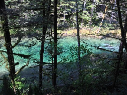
The northern section of the trail does just that. It is nestled between BPA’s Ross Complex and the neighborhoods of Minnehaha. The mid-section meanders along NE Ross street, providing a fascinating view of the large power distribution towers. While the southern section follows interstate 5 until it runs in to Leverich Park. The trail extending southeast from Leverich is known as Burnt Bridge Creek trail.


How did we do it?
Route

ADVERTISEMENTS
There are numerous points where parking is readily available. Here are a few:
- Leverich Park – Three paved parking lots
- Ross Dog Park – One gravel parking lot
- NE 22nd Ave – One narrow, gravel road
- 3303 NE Minnehaha St. – Paved parking lot in front of convenience store
Gear
Standard day hike setup:
- Small pack
- Light shoes
- Non-cotton clothing
- Water & Snacks
- Camera
Trail Tips
- Bring at least one snack and a bottle of water
- Wear comfortable shoes – running shoes will suffice
The Experience
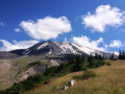
It’s easy to get caught up in attempting progressively more difficult and arduous hikes. After completing trips like Siouxon Loop, Loowit Trail, and the Mt. St. Helens the nagging question became, where do I go from here? The epilogue of one adventure becomes the introduction of the next.
Taking a step back and spending time understanding the core of what it means to travel and see the world is important but often overlooked. While the most difficult and remote hikes extend the bounds of this understanding, I have come to realize that the origins of this journey start as soon as you walk outside. The root is in the green grass of your lawn. It’s the blue of the sky as you make those first few steps out your front door.
In 2013, 34 million Americans deviated from their daily routines and went hiking. So why do we do it? Why do we venture outside of the comfort of our homes to be closer to nature? To understand this better I decided to revisit Ellen Davis Trail.

The reality is I didn’t start hiking dozens of miles at a time in a single trip. I started basic; I started simple. If I couldn’t drive somewhere I walked. For many folks in the Minnehaha area, the ability to walk a few blocks and be on a trail is very convenient.
The big attraction in the area though is Ross Dog park. On any given afternoon, you can drive by and bare witness to dozens of small, furry creatures galloping through the meadows located just beneath the gray tentacles of the Ross Complex sprawl. Animals love the outdoors and they love it when you come with them.
While Ross Dog park is an adventure on its own, another option is Ellen Davis trail. It’s essentially two trails connected by Ross street. This road is a divider that will prevent most people from connecting to the opposite section of the trail. However, this isn’t due to an issue with the road itself. In fact, the trail is situated conveniently a few yards off of the road so that you’re never really walking on it except to cross to the other side. The issue is that it emanates a psychological barrier for many folks and acts as a natural turnaround point for people who only wanted to go on a short walk. That and the happy dog faces draw people away from the trail and into the park.


The northern section of the trail is peaceful and sublime. It doesn’t attract a lot of attention except for the occasional biker or dog walker. Residents in the Minnehaha area are more likely to complete this section only, due to the pavement phobia mentioned above. Another reason for completing this section on its own is that it’s entirely satisfactory for a quick walk. It’s very possible that Ellen Davis trail was never meant to be a complete thru-hike. The roads act as a barrier to the mental relaxation that being around trees and shrubbery often provide. When you pop out at the end of the north section of the trail, the roar of traffic along St. Johns disrupts that.
As I strolled up over the last hill on the north side of the trail, an old man was sitting on a bench that looked out across St. Johns road. The morning sun was shining down and warmed everything it touched. The old man simply sat, unmoving, as the traffic burbled up the hill. I shuddered to think that this was the most welcoming trailhead I had ever seen, but at the same time the most misplaced. It intersected with a sidewalk that had no connection to a parking lot. The closest place to park was a block or two away at a convenience store. The patch of yellow daffodils smiled up at me and the colorful directions on the sign hinted of awesome things further along the trail from which I had just hiked, but the whole scene was misleading.
I turned around and decided to hike to the southernmost end of Ellen Davis. My theory was that there must be some redeeming factor to this trail that holds true to the great promise of this misplaced entry point.
Roughly a mile later I had retraced my steps, walked past the dog park, and was about to embark down the hill into the heart of the trail. As I looked west I could see the cars and hear the white noise of the interstate 5. Unfortunately, on the southern section of the trail this is inescapable.


As I plunged deeper I found many signs of humanity strewn randomly amongst the greenery. There was an unusual amount of toilet paper across all sections of this trail. I wondered if hikers had accidentally put themselves out of range of a restroom, but this seemed unlikely considering that it was nowhere near remote enough. The more likely reason was the local homeless population. In my time spent helping the community clean up local parks, my team had come across entire dwellings formed out of trash and other discarded materials. Organization and cleanliness was never a top priority for the homeless but they were certainly resourceful. They often took up residence in parks with dense shrubbery and bushes. The more experienced transients more always on the move. Staying in one place too long meant discovery and eviction by the authorities.

Despite signs that I was traveling in to a lower income housing area I moved further south. The vibe had turned from peaceful and green to tense and gray as I realized that I had suddenly arrived at Leverich Park. The park is apparently popular for its disc golf course. The hooded participants seemed to be enjoying themselves as they tossed frisbees from one chained goal post to the next. Smoking, laughing, and drinking away the afternoon while throwing around plastic discs on a moderately warm, winter day seemed very much ‘Vancouver’ at that point in time.