Hiking Silver Star Mountain, Washington
What is it?
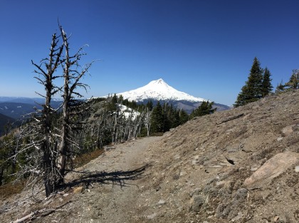
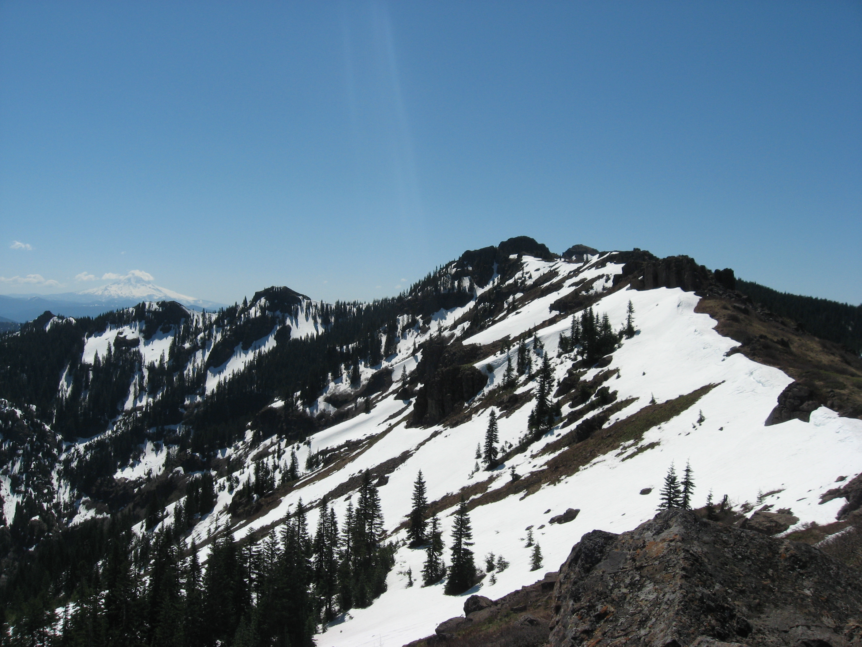
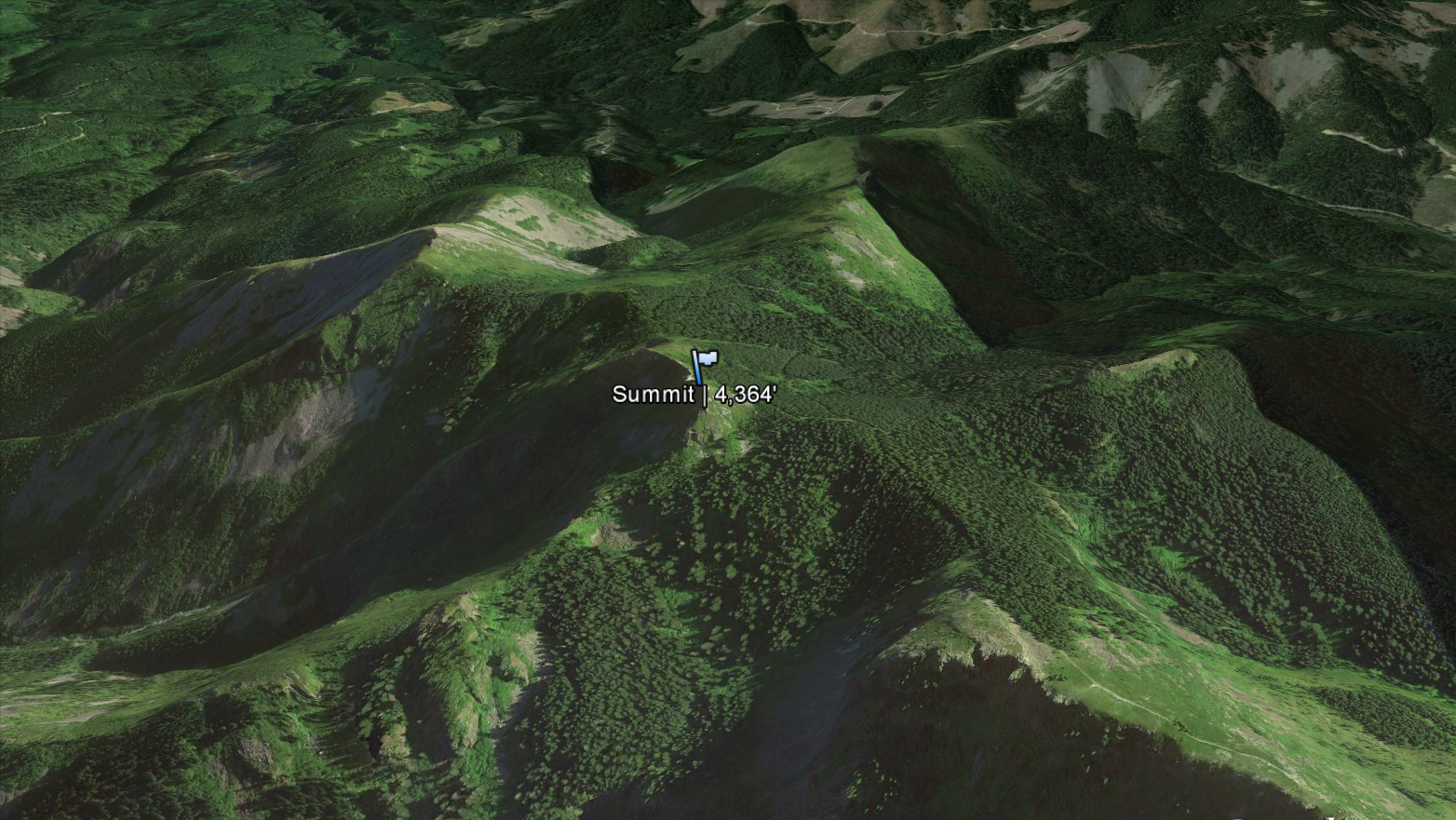
Located on the eastern edge of Clark County, looming on the horizon several thousand feet above the residents of Vancouver, Washington, is Silver Star Mountain (4,364′). However, you wouldn’t notice it because it’s easy to be distracted by larger mountains like Mt. Hood and Mt. St. Helens.

Silver Star Mountain gets its name from its geographical shape and the story of a man trying to strike it rich.
In 1874 an early settler to the area by the name of E.A. Dole struck silver on the mountain. Excited at the prospect of finding more, he built a mine and named it “Silver Star Quartz Ledge.”Others miners soon flocked to the area having heard stories of the “silver mountain.”
Early climbers discovered several routes which traversed five prominent ridges. Seen from the sky these ridge lines radiate from the summit in the shape of a star.

All we know for certain is that this relatively modest peak provides exceptional views of the Vancouver and Portland metro areas as well as nearly every significant peak in the region. Here are a few of the big names that can be seen from the summit on a clear day:
- Mt. Hood
- Mt. Adams
- Mt. St. Helens
- Mt. Rainier
- Mt. Jefferson

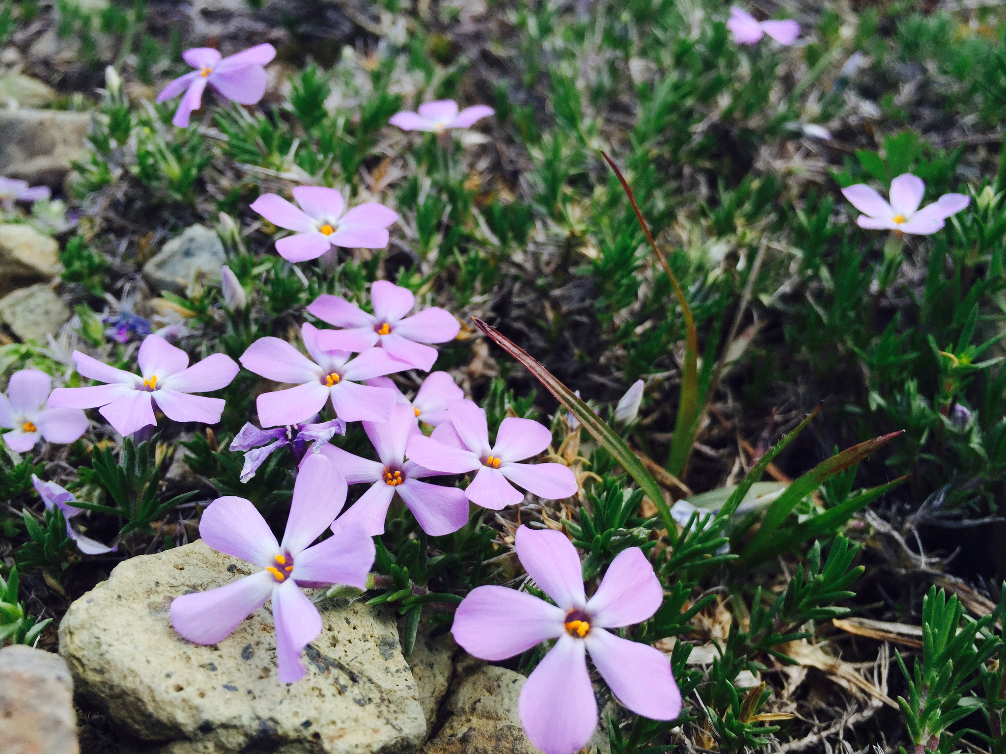
Aside from the far reaching views, the wild flowers and the fresh air, you might begin to notice that the surrounding peaks are forested but the silver star trail is relatively bare. Why is that?
In 1902, a series of fires known as the Yacolt Burn ravaged the area – destroying minerals and seeds in the soil. While some vegetation has returned to the area the trees, for the most part, have not giving Silver Star mountain an unusually barren appearance.
In a curious twist, the summit of Silver Star Mountain used to be the site of a fire lookout though very little is known about its history. According to one source, the fire lookout had not been built when the 1902 fires swept through the region. Had it existed the the mountain might still be covered in trees today.
Like other mountain lookouts, this was one was decommissioned many decades ago. All that’s left is a concrete slab on the north peak.
Where is it?
ADVERTISEMENTS
The various trailheads that terminate at the summit of Silver Star Mountain can be challenging to reach. Depending on weather, some forest road routes may be gated off entirely. We recommend checking USDA.gov for any forest road closures when decided on a trailhead.

Driving directions are for Silver Star Trailhead (45.772570, -122.244358)
Using a GPS combined with a printed map is highly recommend. Do not depend on having cell service to navigate.
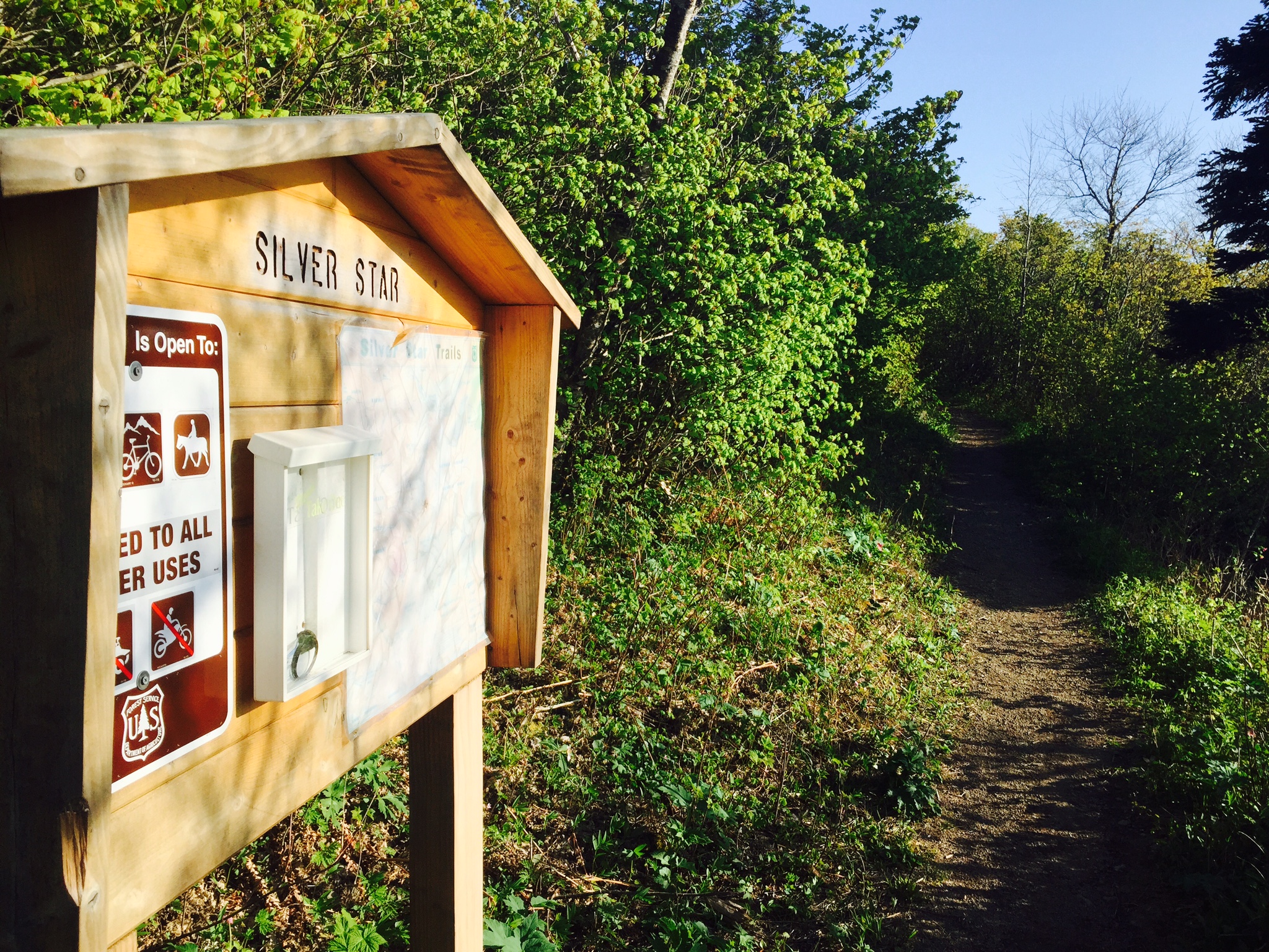
Do not expect the route to the trailhead to be well-marked. The only sign indicating that you are close to Silver Star Mountain is the one at the Silver Star trailhead, and even that is tucked away behind overgrowth.
- Silver Star Trailhead GPS: 45.772570, -122.244358
- Chinook Trailhead GPS: 45.770311, -122.260943
- Grouse Vista Trailhead GPS: 45.721870, -122.269482
- Starway Trailhead GPS: 45.788452, -122.222525
- Bluff Mountain Trailhead GPS: 45.780535, -122.165982
The Silver Star trailhead is the most popular, however the last leg of the drive can be challenging for vehicles that are not high clearance. See additional information about the routes below.
How did we do it?
Silver Star Mountain a truly rewarding day hike but the biggest challenge isn’t the hike itself but finding and making it to the trailhead. What follows is additional information about the various routes, gear, and nutrition.
Route
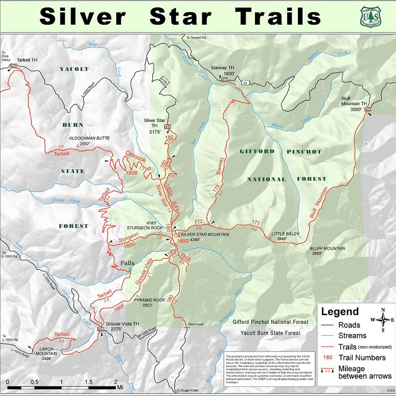
There are many routes to the summit of Silver Star Mountain. Here is list all of the major trails that are called out by the USDA.
We used the Silver Star and Chinook trailheads out of sheer convenience. However, the challenge can be increased by taking a longer route.
- Silver Star Trailhead:
- 2.5 miles – Trail #180 to Trail #180D to Summit
- 2.9 miles – Trail #180 to “Ed’s Trail” #180A to Trail #180D to Summit
- Chinook Trailhead:
- 4.1 miles – Trail #180B to Trail #180 to Trail #180D to Summit
- Grouse Vista Trailhead:
- 4.5 miles – Tarbell Trail to “Sturgeon trail” #180C to Trail #180 to Trail #180D to Summit
- 3.0 miles – “Grouse Vista trail” #180F to Trail #180 to Trail #180D to Summit
- Starway Trailhead:
- 4.9 miles – “Starway trail” #175 to Trail #172 to Trail #180D to Summit
- Bluff Mountain Trailhead:
- 6.2 miles – “Bluff Mountain Trail” #172 to Trail #180D to Summit

ADVERTISEMENTS
Gear
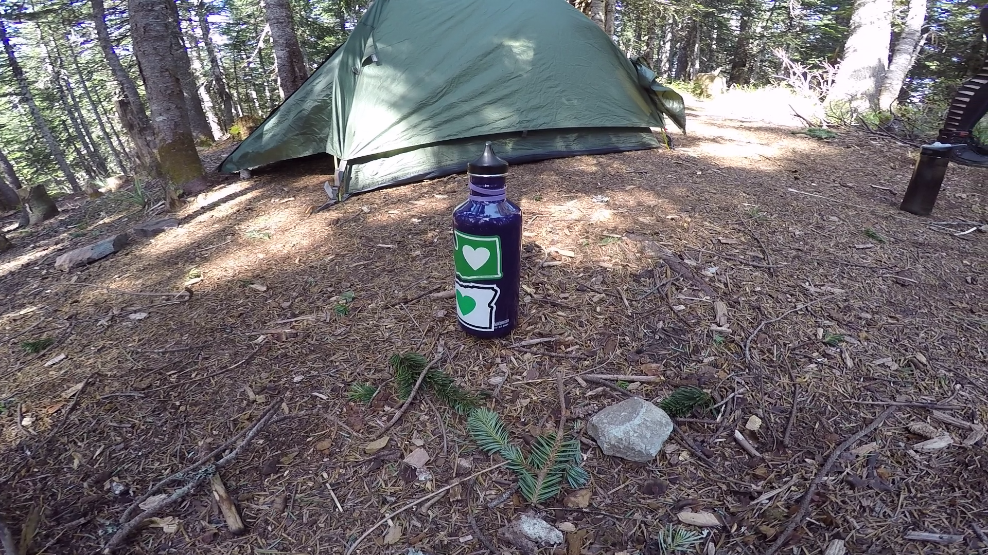
Silver Star Mountain is widely considered to be a day hike, however there are remote spots that are used for camping.
As such, you can have a little bit of fun with your gear choices. A few basics apply:
- First aid kit
- Water (2 liters)
- Food (enough to sustain you for the duration of your hike and maybe even a bit more just in case)
- Multi-tool or pocket knife

Food & Water
Snacks will suffice. If you are staying overnight you will want to meal plan. Here is an example:
- Dinner: Steaks
- Breakfast: Oatmeal
- Snacks: Bars, crackers, chips, fruit
There are no sources of water on Silver Star Mountain. Unless there is that can be melted for water. Remember: It takes water to make water. A tiny bit of water is required in order to melt snow without burning it.
