Coyote Wall, Washington – The Division Bell of the Gorge
If you’re looking for a trail guide with solid repute go play with your internet somewhere else because this isn’t it. This is a story about two hikers just mad enough to start walking straight through undergrowth, untouched in decades all because the GPS said so.
However, I will give you some coordinates that lead directly to the trailhead.
What was supposed to be a 7.8 mile lollipop loop turned into a 14.5 mile off-trail excursion rife with chocolate jelly beans, power wire zip lining, rusted Wall-E ancestors, fuzzy rocks, a killer donkey, and a haunted Mickey Mouse house.

No, I’m not. So put down your bear canister full of pop tarts and pay attention because we’re about to turn a leisurely mountain bike trail loop into Tim Burton’s Full Metal Jacket remake.

This hike still contains some of the basics that you will find in most traditional day trips through the gorge. Things like the Columbia River, trees, rocks, cliffs, amazing panoramic views, a mountain or two on the horizon – you know, the common bits that us Pacific Northwest hikers have been spoiled with since our first steps on nearly any trail in this region.
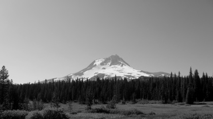
Before we go any further full disclosure is required. Off trail excursions are not recommended and rampaging through private property is highly offensive to civilized society. In our travels, we respected property boundaries and did our best to follow a visible trail whenever possible.
Through natural derping around, the Coyote Wall trailhead will take you along old highway 8 which, quite frankly, produces a scene straight out of the apocalypse. It’ll tickle your inner Walking Dead geek.
So what happens when you just keep following old highway 8 east? Well, eventually it will loop back to highway 14. However, the idea hit that we should get off this road and just climb up the side of the gorge. Why? We wanted a better view.
From a position of moderate elevation we were able to look back and drink in a partly cloudy view centered around the east end of the gorge.


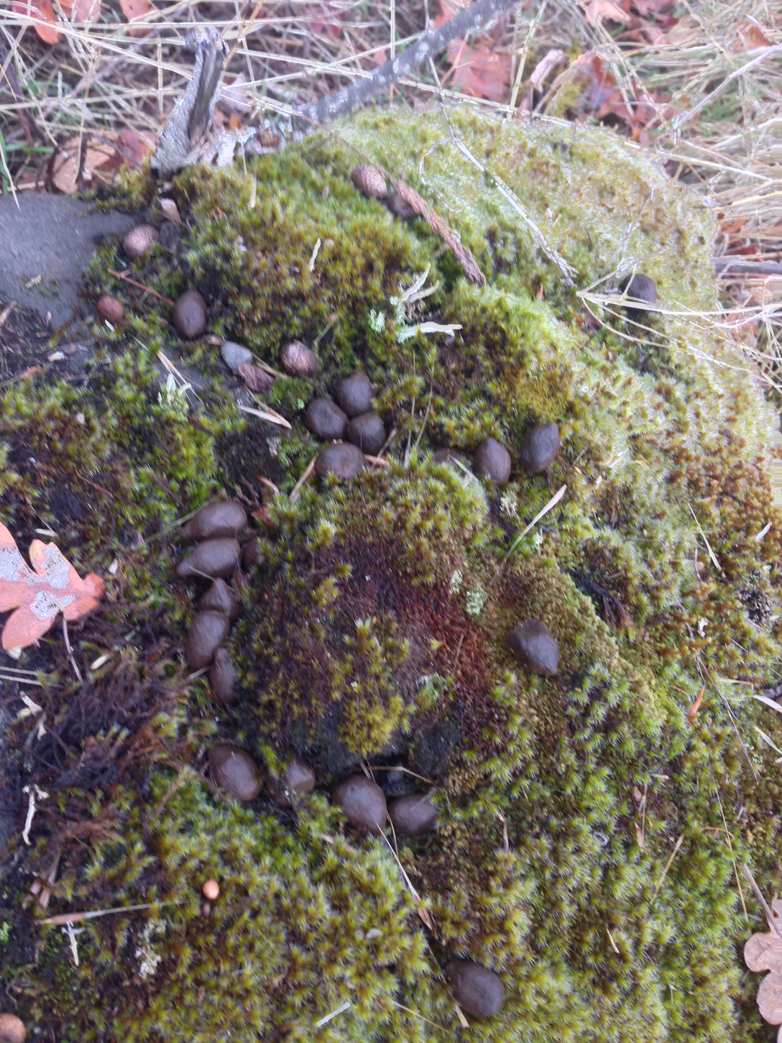
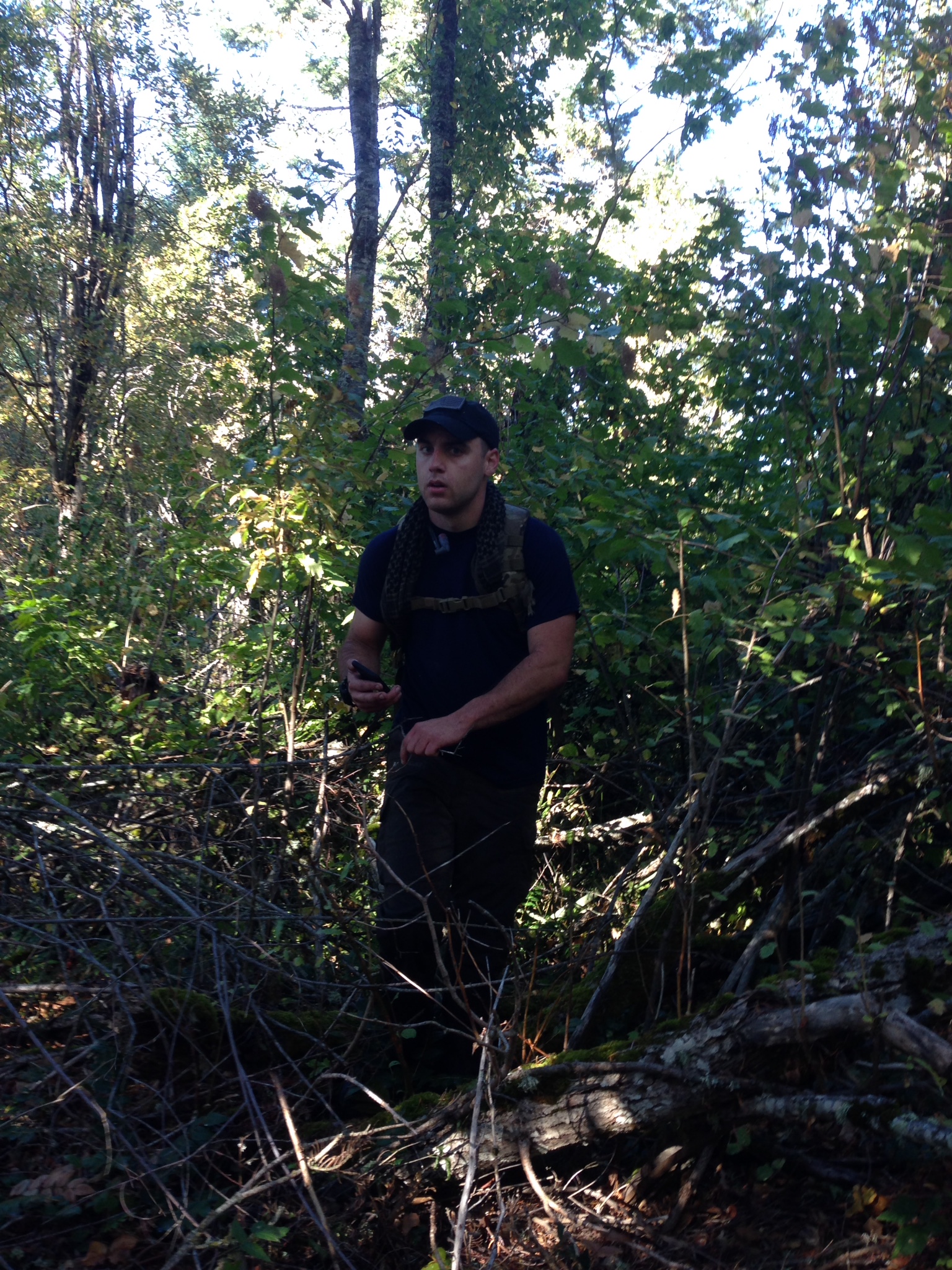
My hiking partner, Cheval, is a fairly astute individual. On several occasions his keen eye has honed in on potential obstacles and threats to the objective at hand. For example, he was able to identify a hunter more than a thousand feet away. Being October, this wasn’t unusual, but we began to wonder if we had wandered too far east. Then we noticed the chocolate jelly beans.
Younger, less mature hikers may be tempted to consume these. We encourage you to train them on the wild, and often unpredictable, ways of nature early on so as to avoid unintended consequences. Be aware of your surroundings.

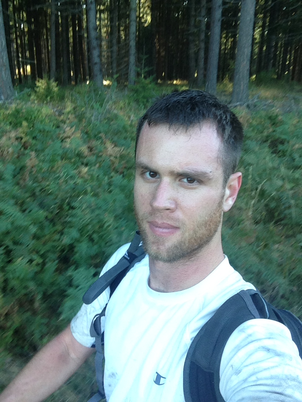
We continued east. The rain rolled in briefly but it felt refreshing on this mild day in mid-October. We were far from cold as we hiked along a clearly visible dirt trail which weaved through the dead brown grass and scraggly trees. With light packs it’s easy to feel like you can go for miles and miles.

Between our two packs we were geared up to survive in this wilderness for as many days as it took. Day packs loaded with the bare essentials was all we had, but that’s really all we needed. When push comes to shove a truly light weight pack should weigh no more than 5 or 10 pounds. Nature has the potential to provide everything else.
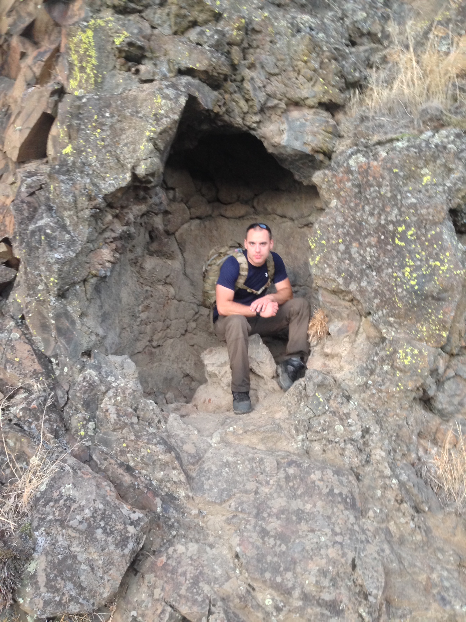
It wasn’t until we went so far east that we hit dense forests that things started to get weird. As the trail began to get narrow, the trees closed in and the secret artifacts of days gone by started to emerge from the protective confines of the wilderness.

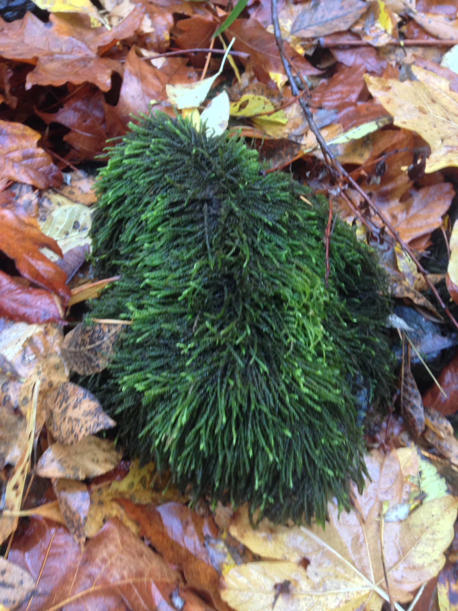
Strange vibes emanated from the area that we later discovered was Catherine Creek. We found old timey amber-brown moonshine bottles strewn around in patches of forest too remote for the casual bender. Our snacks consisted of delicious beef steak nuggets introduced to a place where non-MSG food had never traveled before. There were rocks with moss so overgrown that it would put most hipster beards to shame.

We had reached the property boundary of the national forest and by this point our hiker senses told us that a distinct path was needed. With a few toggles of the GPS we soon became aware of a few private plots of land and a public road to our immediate northwest. It didn’t matter that pure forest and shrubbery lay directly between us and a public road, we decided to go straight through it until…

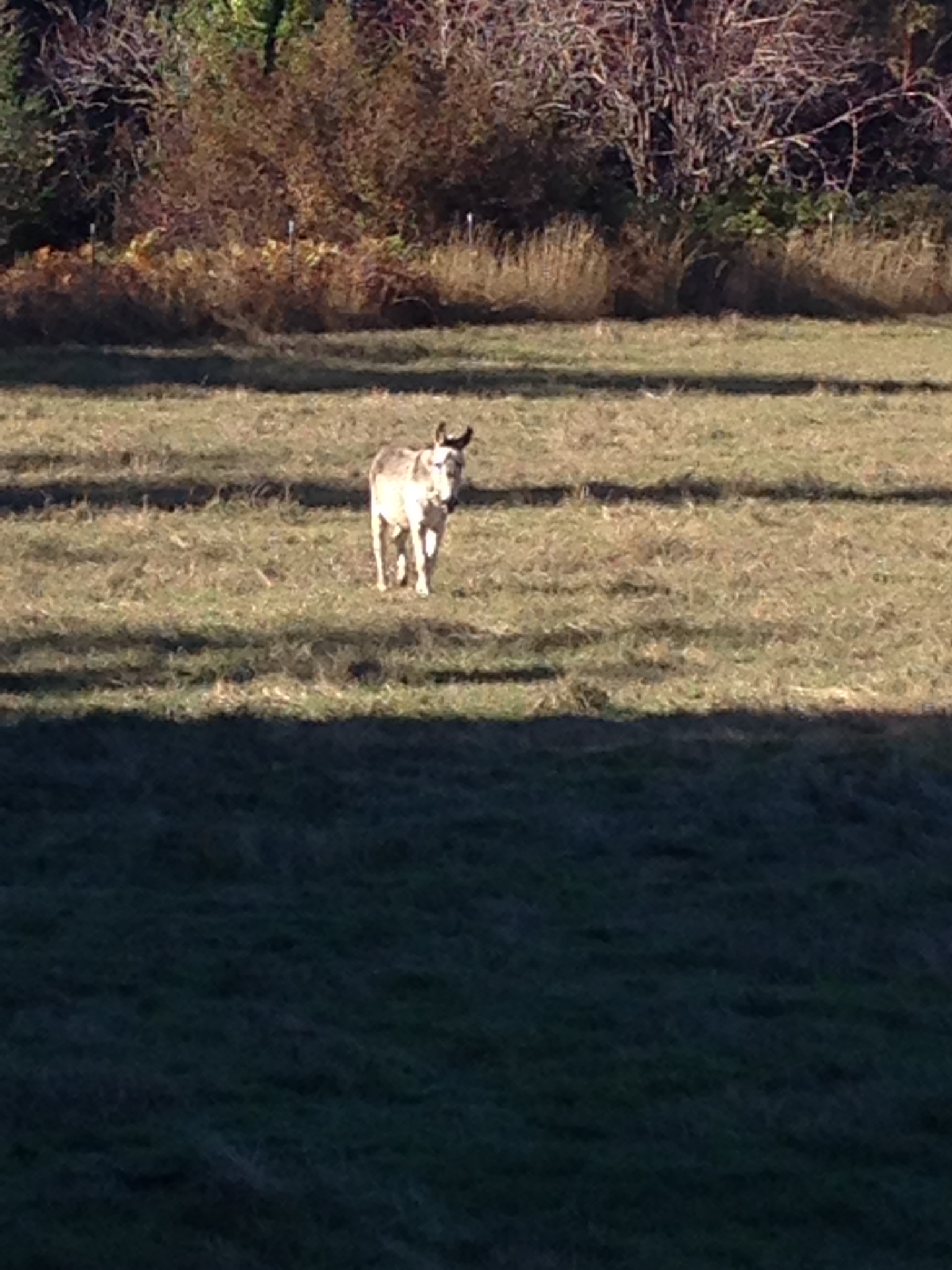
After barrelling through a thick wall of leafy green we erupted unceremoniously on to an open field. Then we heard a loud snort.
Cheval: “Dude, don’t get any closer to it. I don’t think it wants us to be here.”
Me: “Don’t be silly, I think it just wants its fair share of our beef nuggets – like a toll for passing through, ya know?”
Cheval: “What? No! Donkeys have been known to attack humans. They can be very aggressive when they feel that their territory has been breached.”
Me: “Something tells me this donkey just wants a friend. I know – I’ll donate Zed!”
I walked closer to the donkey and it snorted again with irritation. Suddenly, it lowered its head and began to trot towards us. Several explicit words were shouted as we dove back into the dense forest from which we came. The donkey was never heard from or seen again.

The trip only proved to get stranger as we ran into more signs of civilization. Small pockets of rural communities, most of them abandoned, but some of them populated by folks of different strokes. We did our best to remain invisible, but even when we walked right in front of them they didn’t even sneak a quick peak. We didn’t even have to try. It was as if they were in their own world and nothing as ridiculous as two day hikers with grubby shirts this far out in the back country could pierce that bubble.
Finally, we stumbled across the section of Bristol road that is located closest to the northern stretch of Catherine Creek.
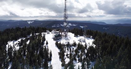
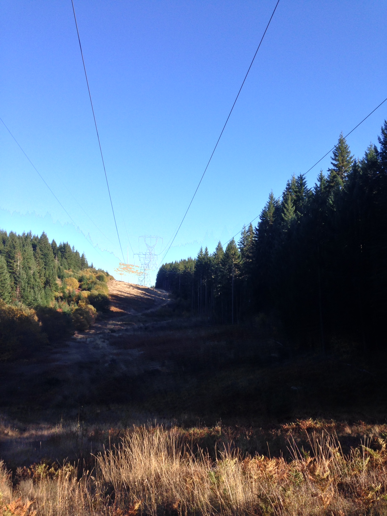
The GPS indicated that we could follow this road for an inhumane number of miles until it snaked back to highway 14, or we could cut through a long strip of territory owned by the Bonneville Power Administration. This worked to our advantage because it was a long section of land that had been deforested by the BPA in order to string power lines from Bonneville Dam to the good folks in the surrounding region.

In fact, there are quite a few 4×4 roads out here that are used by service vehicles and, undoubtedly, recreational activities. Strange pockets of humanity littered the landscape. No trespassing signs became more evident the further away from civilization we got, which seemed strange considering that such signs make more statistical sense when the density of the local population increases, but I digress.
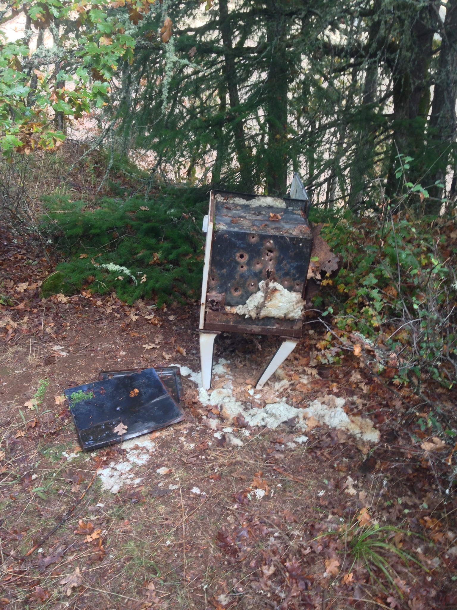
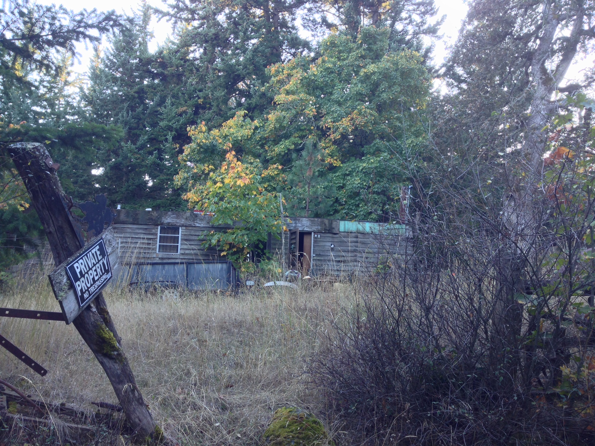
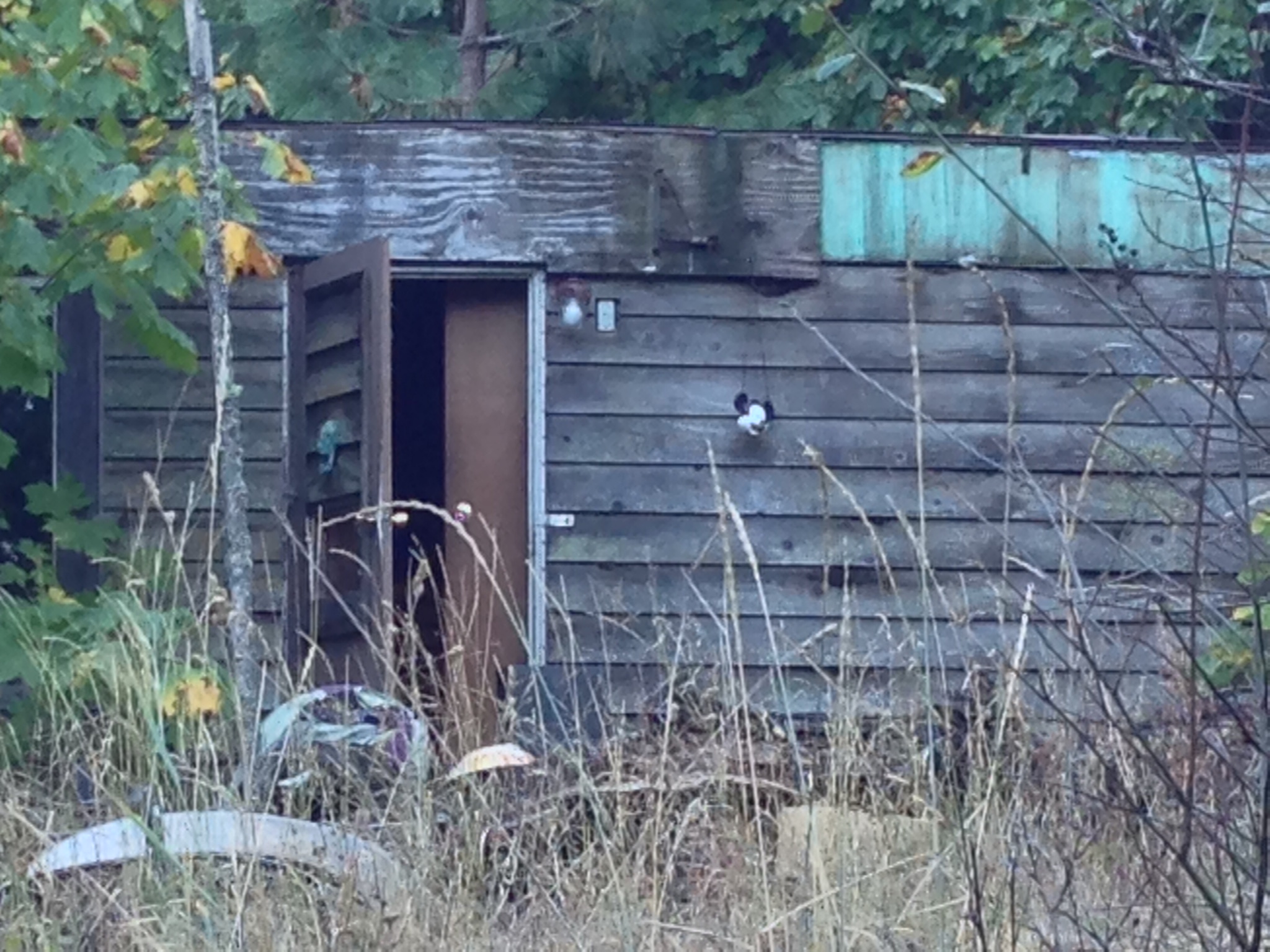
It wasn’t until our fateful trip down Cooke road commenced that we witnessed true backwoods horror.

Due to resolution constraints you can’t really get the full affect of this dilapidated, danger zone until you zoom in and look carefully to the right of the open door.

Terrified at the prospect of looking too deeply into the shadows of this clearly abandoned home and having our souls devoured, we trekked on. This was the turning point. We knew that it was always darkest just before the dawn and that just to our south would be the top-most point of Coyote Wall. We just needed a sign that we were close.

We can conclude with the realization that many people have after visiting Coyote Wall, which is that the natural beauty of the Columbia River Gorge has many facets. The ridge of basalt that stretches out towards the river provides a taste of eastern Washington while preserving much of the greenery that the western side of the state enjoys. It bares witness to the brilliantly, blended landscape arranged tastefully at the beginning of the gorge. I have no doubt that you will enjoy the more domesticated version of this hike, whether you are on foot or on bike.